Pre-CalNex TOPAZ Lidar data
Preliminary Data
| July 2009 |
|---|
| S |
M |
T |
W |
R |
F |
S |
|
|
|
1 |
2 |
3 |
4 |
| 5 |
6 |
7 |
8 |
9 |
10 |
11 |
| 12 |
13 |
14 |
15 |
16 |
17 |
18 |
| 19 |
20 |
21 |
22 |
23 |
24 |
25 |
| 26 |
27 |
28 |
29 |
30 |
31 |
|
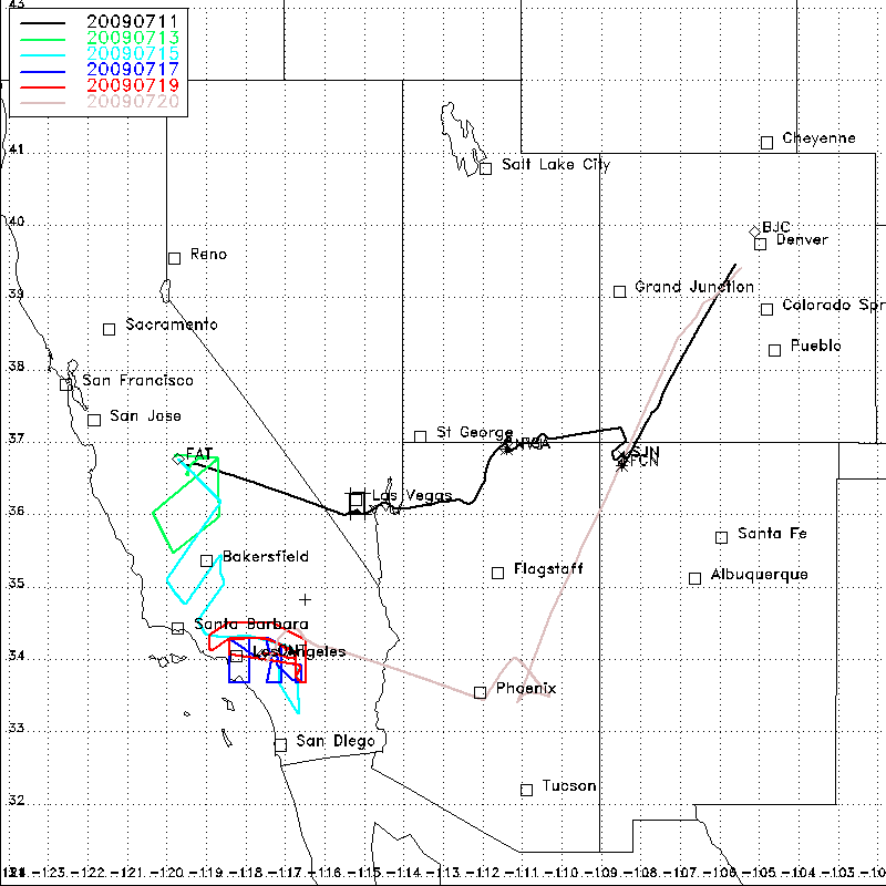
In July 2009, a short pilot study (Pre-CalNex) was conducted in preparation for the larger CalNex study in 2010. The Pre-CalNex study involved the NOAA Twin Otter aircraft with the TOPAZ airborne ozone and aerosol lidar and the CU-Boulder AMAX-DOAS (PI: Rainer Volkamer) instruments on board. The Twin Otter based at Fresno, CA for 5 days and at Ontario, CA for another 5 days. Objectives of this pilot study included the investigation of the distribution and horizontal and vertical transport of O3, NO2 and aerosols in the San Joaquin Valley and LA Basin, transport of pollutants between air basins in Southern California, characterization of large, isolated power plants in the southwestern US (on the transit flights), and comparison of NO2 AMAX-DOAS measurements with OMI satellite data.
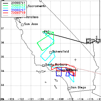
Flight track map for Pre-CalNex (California only)
 |
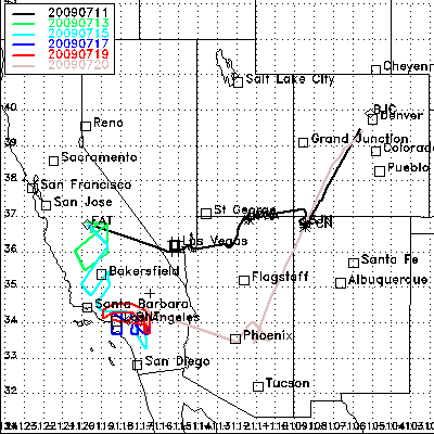
Flight track map for Pre-CalNex
 |
|---|