Pre-CalNex TOPAZ Lidar data
July 11 - Preliminary Data
| Previous Flight | Archive Calendar | Next Flight |
|---|
Flight #1 (Saturday): Transit flight from Boulder to Fresno
Flight level: 16500' & 17000', Takeoff: 8:30 MST, Duration: 8:30 h (incl. refueling stop)
From Rocky Mountain Metro Airport we flew straight to the Four Corners and San Juan power plants in NW New Mexico near Farmington. There, we flew one upwind transect and several transects downwind of both power plants, to investigate NO2 and ozone signatures associated with the power plants. Both, the TOPAZ lidar and AMAX-DOAS had been upgraded to measure SO2 concentration prior to the study. SO2 emitted by the Four Corners and San Juan power plants provided an opportunity to test these new measurement capabilities. We then flew directly to Page, AZ for a refueling stop. We began the second leg of the transit flight with an investigation of the Navajo power plant plume at about the time of the OMI satellite instrument overpass. Stormy weather in the vicinity of the power plant only allowed us to do a partial survey of the Navajo plant. We could not identify any power plant plume signatures, probably because the erratic wind patterns associated with the storms had dispersed and diluted the plume. We proceeded to Las vegas, NV, where we flew a box pattern around the city. We did not observe any elevated ozone downwind of the city. Again, rather strong winds associated with thunderstorms most likely flushed out the urban pollution plume. The last portion of the transit flight was flown at 17000' (IFR) and took us over Death Valley and the Sierra Nevada into Fresno. On the descent into Fresno, we observed a shallow layer with high ozone levels along the eastern slope of the Sierra.
Select an image to view full resolution
Ozone Cross-section |
Aerosol Cross-section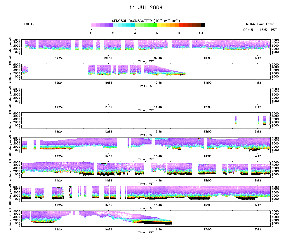 |
Ozone Map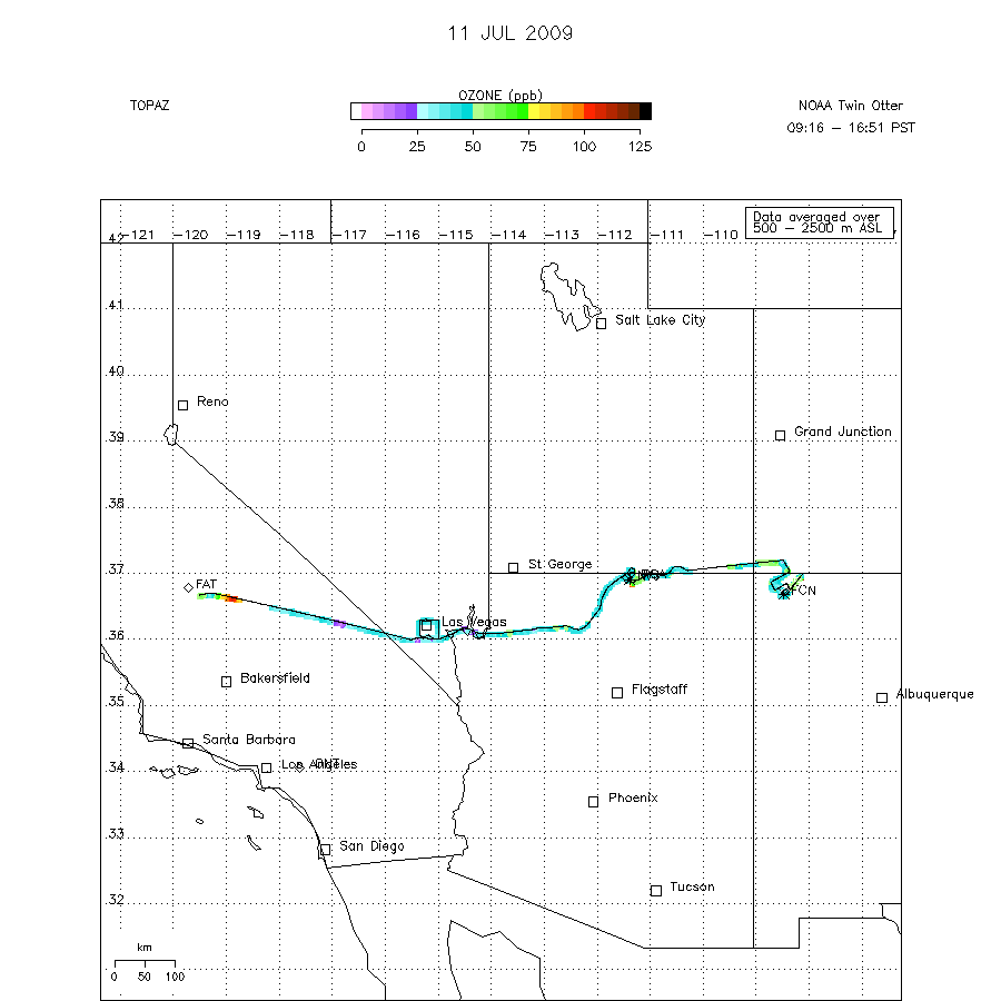 |