New shipboard system will study water and carbon dioxide fluxes on the Great Lakes
Many communities rely on lakes for a variety of purposes, including drinking water, shipping, fisheries management, and recreation. However, a lake's water level can impact these uses. Evaporation is the key process affecting variations in water level; therefore, accurate measurements of evaporation are critical for improving models and forecasting changes in water levels, as well as lake-effect snow and water temperature.
Evaporation is especially important for the Great Lakes—primarily due to their sheer size and volume. This week, researchers from NOAA ESRL's Physical Sciences Laboratory (PSL) and the University of Colorado Boulder (CU) will undertake a new study of evaporation on the Great Lakes. They will install an instrument package aboard a ship to measure atmospheric exchanges (or fluxes) of water and carbon dioxide across the Great Lakes and their impact on freshwater evaporation. Previous studies have convincingly shown that fluxes of heat and moisture are largest in the winter. Less is currently known about the seasonality and effect of carbon dioxide fluxes on the lakes.
"We've taken these types of measurements many times on the ocean. But the freshwater observations will be in our own ‘backyard' where the effects of evaporation and water level are so important," said Dan Wolfe a research meteorologist with PSL and the Cooperative Institute for Research in Environmental Sciences (CIRES).
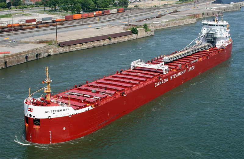
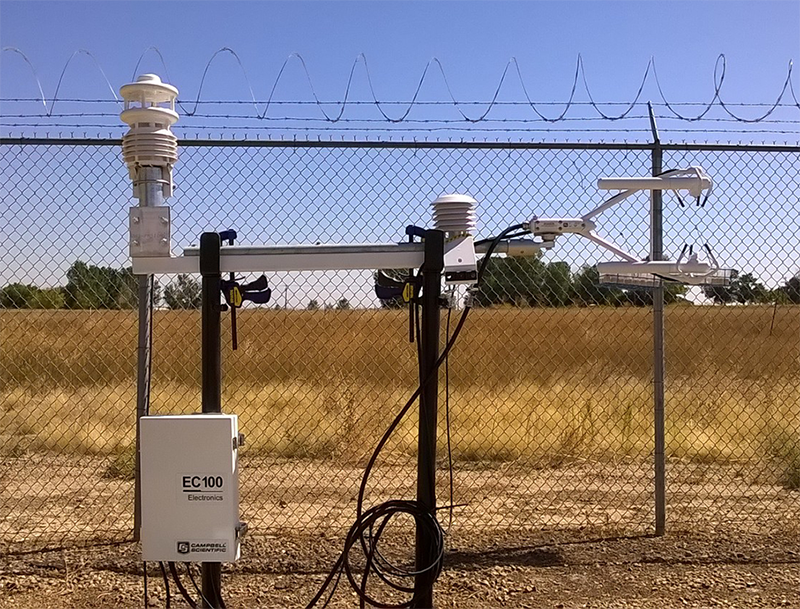
The PSL/CU research team has developed a modified version of NOAA's Air-Sea Flux System—which is used to study fluxes of heat, water, and momentum between the ocean and the atmosphere—for use in freshwater applications. In cooperation with Canada Steamship Lines, this new ‘Freshwater Flux System' will be installed on a bulk carrier ship, the Whitefish Bay, which routinely crosses the Great Lakes.
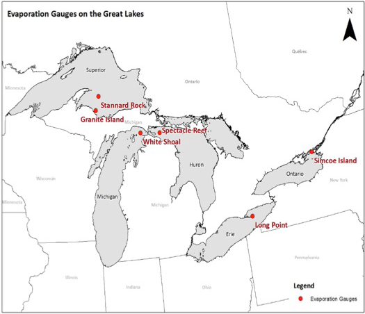
This project is a joint effort between PSL, CIRES, CU's Department of Geography, and NOAA's Great Lakes Environmental Research Laboratory (GLERL) and is a follow-on to continuous measurements from three offshore Great Lakes locations, including Lake Michigan (White Shoal Lighthouse), Lake Huron (Spectacle Reef), and Lake Superior (Stannard Rock). These locations, in addition to other established Great Lakes Evaporation Network sites, will serve as calibration points as the vessel passes by. The lighthouse measurements sample an upwind distance of roughly 8 kilometers, and these remote sensing techniques are limited by persistent winter cloud cover. Continuous shipboard measurements gathered as the ship traverses the Great Lakes over the next two to three years will provide the data the research team needs to examine presumed large spatial variations in water and carbon dioxide fluxes.
"It's exciting to work on this project with colleagues at GLERL and learn more about their research on the Great Lakes. Living in Colorado, I haven't had the opportunity to study this region," said Wolfe. "It will be very interesting to see how these data impact current models."
Posted: February 27, 2017