Hazard Communication Forum for California Multi-Hazards Project on Winter Storms
29 January 2009
|
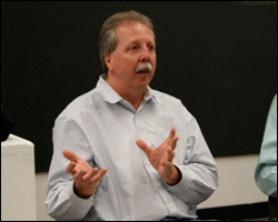 Marty Ralph participating on design forum panel |
 Some of the design student participants |
Researcher Marty Ralph, of NOAA's Earth System Research Laboratories, was a panel member at a Hazard Communication Forum at the Art Center College of Design in Pasadena, CA on January 23, 2009. The focus of the forum was to address how to effectively design and communicate hazards information. The outcome of the panel discussions will be for students at the college to create public campaign materials for a USGS Multi-Hazards Demonstration Project on winter storms. Dr. Ralph is collaborating with the USGS Multi-Hazards project team to design what a plausible worse-case-scenario storm would look like for use in a large-scale emergency preparedness drill in California. He and Dr. Mike Dettinger of USGS/Scripps are leading the "atmospherics scenario team" that has been assembled to define the physical attributes of the event, which will then be reviewed by another team, and will become the basis for the emergency management community to define their exercise. The atmospherics team includes representatives of NOAA/NWS and local experts on extreme West Coast storms and flooding.
The first USGS Multi-Hazards drill, The Great Southern California Shakeout, successfully took place on November 13, 2008. Millions of people and thousands in the emergency response community throughout the region participated in this earthquake preparedness activity to practice how to act quickly and protect themselves.
Partnering with USGS, a similar awareness campaign and drill for severe West-Coast winter storms is a priority for the state, since such storms present a major hazard for flooding in many regions of California. For example the city of Sacramento sits at the confluence of the Sacramento and American Rivers and represents a flood-risk that is comparable to that of New Orleans before hurricane Katrina. In addition, the project has identified an historical flood sequence from the mid-1800s after which to model the storm scenario. That event is in some key ways the flooding analogue to the 1906 San Francisco earthquake.
Effective communication to a wide and varied audience of California residents presents a huge challenge in emergency preparedness. By providing state-of-the-art information on weather and water issues, NOAA is helping to increase awareness of potential hazards and contributing to public safety.
Photo credits: Barb DeLuisi, NOAA
| Contact: Marty Ralph | More Info:
|