Tropospheric Chemistry: Projects
Field Campaigns
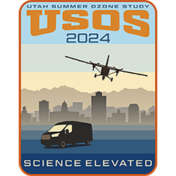
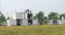
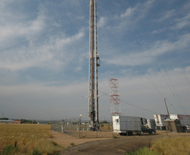
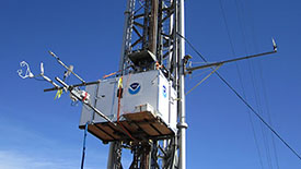
USOS, Salt Lake City, Utah. Researchers will investigate summertime ozone in the Wasatch Front region of northern Utah during the Utah Summer Ozone Study (USOS) in the summer of 2024. NOAA CSL will carry out observations through a combination of mobile laboratory (instrumented vehicle and small aircraft) measurements and augmentation of fixed ground sites with research grade instruments. More Info
AiRMAPS, Colorado and Utah, Baltimore and Marcellus Shale, Texas and U.S. Southwest, Western U.S. O&G Basins, Marcellus Shale and Urban Midwest. Airborne and Remote sensing Methane and Air Pollutant Surveys (AiRMAPS) is a series of studies in 2024-2028 across the U.S. to provide comprehensive and quantitative top-down emissions data for methane, other greenhouse gases (GHGs), and major air pollutants from oil and gas (O&G) production basins, and selected urban and agricultural areas. NOAA OAR and NESDIS lead this investigation of greenhouse gas and air pollutant emissions and impacts. More Info

AEROMMA, Coastal U.S. megacities. Atmospheric Emissions and Reactions Observed from Megacities to Marine Areas (AEROMMA) addresses emerging research needs in urban air quality, marine chemistry influences on cloud formation, and interactions at the marine-urban interface. Researchers will investigate anthropogenic and marine emissions that alter tropospheric composition and impact air quality and climate from science flight and ground site activities based in Palmdale, California, Dayton, Ohio, and the NYC metro area during Summer 2023. More Info

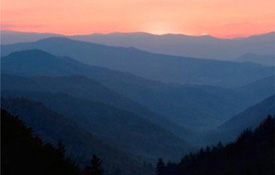
CalFiDE, California. The California Fire Dynamics Experiment (CalFiDE) is a six week study of wildfire behavior and its response to spatially and temporally evolving wind fields in the California summer of 2022. The experiment will provide new data on the emissions and chemistry leading to ozone formation in wildfire plumes and in populated areas impacted by these plumes. Instrumented mobile platforms include the NOAA Twin Otter with a payload measuring atmospheric chemistry compounds. More Info
SCENTS, CSU Science Chamber. Secondary organic aerosol Chamber Experiments for Non-Traditional Species (SCENTS) during Spring and Summer 2022 will provide a unique opportunity to study oxidation products, which is necessary preparation for AEROMMA. More Info
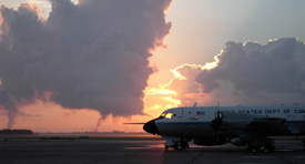
SABRE, Ellington Field. Stratospheric aerosols are an important component of Earth's albedo, and therefore energy balance, and provide surface area for heterogeneous chemistry, which can lead to stratospheric ozone loss. Acquiring a comprehensive database of stratospheric aerosol, trace gas and dynamical observations to establish the baseline state and background variability of the stratosphere is essential. CSL integrates instruments aboard the the NASA WB-57 research aircraft. Test flights commence from Ellington Field, Houston, Texas in January 2022. An Arctic deployment occurs February-March 2023, followed by tropical science Summer 2025 and southern hemisphere science Summer 2026. More Info

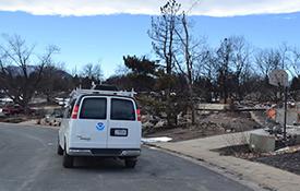
Marshall Fire Air Quality Response, Superior and Louisville, Colorado. When the Marshall Fire tore through Superior and Louisville on 30 December 2021, it destroyed more than 1,000 homes and damaged nearly 150 others. At the request from Boulder County Public Health and Colorado Department of Public Health and Environment, investigators drove the mobile laboratory through neighborhoods to understand the lingering effects of smoke in outdoor air quality. More Info
SUNVEx, Los Angeles, CA and Las Vegas, NV. Southwest Urban NOx and VOC Experiment (SUNVEx) addresses emerging research needs in urban air quality ahead of AEROMMA. The project is part of Re-Evaluating the Chemistry of Air Pollutants in California (RECAP-CA) and evaluates ozone formation and its sensitivity to NOx and VOCs in Las Vegas. Researchers will investigate anthropogenic emissions that alter tropospheric composition and impact air quality and climate from ground-based activities during Summer 2021. More Info
COVID-AQS, Boulder, Colorado. The COVID-19 outbreak was a never before seen health crisis that completely disrupted our way of life. It provides an unprecedented opportunity to assess changes in U.S. emissions and urban air quality due to decreased traffic and economic activities. Measurements made from the NOAA David Skaggs Research Center in Spring 2020 will be analyzed and compared to past in situ measurements at CSL, along with satellite data, and used in regional air quality models. More Info
FIREX-AQ, Western U.S. Fire Influence on Regional to Global Environments and Air Quality (FIREX-AQ) is a NOAA / NASA interagency intensive study of North American fires during the 2019 wildfire season. The project combines the previously separate NASA FIREChem and NOAA FIREX aircraft campaigns to better study the atmospheric effects of wildland and agricultural fires in the U.S. This offers significant advantages to the research community by optimally leveraging the scientific interests, personnel, and assets of NASA, NOAA, other agencies, and academic partners in a fully integrated program of field measurements, modeling, and interpretation. More Info

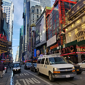
NYICE, New York City metro. Researchers drove an instrumented van (our Mobile Laboratory) into New York City for the New York Investigations of Consumer Emissions (NYICE) project in March 2018. Investigators were particularly interested in volatile organic compound (VOC) emission source areas in and around the New York City (NYC) metropolitan area (comprised of portions of New Jersey, New York, and Connecticut in and around NYC). Researchers parked the mobile lab at City College of New York, taking measurements among a dense population as a ground site. In addition, researchers acquired data during daytime drives up and down Manhattan, staying close to Times Square at morning and evening rush hour, and around the metro area. They returned in July 2018 for measurements during the summer season. More Info
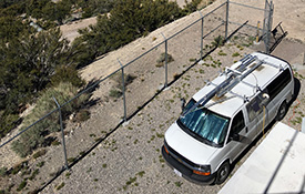
FAST-LVOS, Angel Peak, Nevada. The Fires, Asian, and Stratospheric Transport - Las Vegas Ozone Study (FAST-LVOS) seeks to understand the major sources of surface ozone in Clark County, Nevada, and study why ozone levels there sometimes soar above healthy levels. The study also puts emphasis on characterizing the roles of emissions from regional wildfires and pollution from southern California in addition to transport from the stratosphere and from Asia. An instrumented van (our Mobile Laboratory) is stationed on a mountain top overlooking Las Vegas during May - June 2017 for near daily measurements. More Info
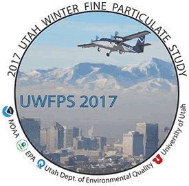
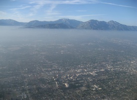
UWFPS, Northern Utah. The urban air basins along Utah's Wasatch Mountains, a region with 2.4 million residents, experience some of the most severe particulate matter (PM) air pollution in the Nation. The Utah Winter Fine Particulate Study (UWFPS) aims to investigate the particulate matter in the basins of northern Utah in wintertime of 2017, and quantify Utah's starting point for compliance to the National Ambient Air Quality Standard (NAAQS) for particulate matter concentrations. More Info
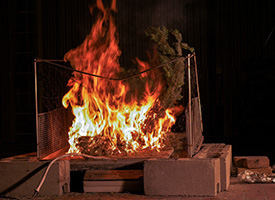
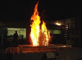
FIREX FireLab, Missoula, Montana. Wildfires have implications for air quality and carbon release, and changes in climate sharpen the problems involving widfires in the western U.S. The Fire Influence on Regional and Global Environments Experiment (FIREX) is a coordinated research effort to understand and predict the impact of North American fires on the atmosphere and ultimately support better land management. Laboratory studies at the USDA Fire Sciences Lab in Missoula commence in the fall of 2016. More Info
ATom, NASA Armstrong Flight Research Center. The Atmospheric Tomography Mission (ATom) studies the impact of human-produced air pollution on greenhouse gases and on chemically reactive gases in the atmosphere. Airborne instruments look at how atmospheric chemistry is transformed by various air pollutants and at the impact on methane and ozone which affect climate. Observations occur seasonally over three years (2016-2018). Flights aboard NASA's DC-8 originate from the NASA Armstrong Flight Research Center in Palmdale, California, fly north to the western Arctic, south to the South Pacific, east to the Atlantic, north to Greenland, and return to California across central North America for a systematic, global-scale sampling of the atmosphere. More Info

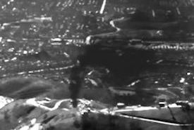
Aliso Canyon Study, Los Angeles, California. On 23 October 2015, a well blowout occurred at the Southern California Gas Company's Aliso Canyon underground storage facility near Los Angeles. Scientists at CSD quickly teamed with colleagues at Scientific Aviation, the University of California, and the California Energy Commission to assess the 60 atmospheric impacts of the leak. They began airborne and ground measurements two weeks after the blowout to quantify the leak rate of methane, a powerful greenhouse gas. Their 13 research flights and ground data gave an unprecedented "end-to-end" benchmark of the total amount of methane that had leaked: 97,100 metric tons, the largest methane leak in U.S. history. More Info
SONGNEX, Western U.S. The goal of the Shale Oil and Natural Gas Nexus (SONGNEX) 2015 program is to quantify the emissions of trace gases and fine particles from several different tight oil and shale gas basins in the western U.S., and to study the chemical transformation of these emissions. The study focuses on basins which represent a mixture of oil and gas production regions at various stages of development. This airborne study involves the NOAA WP-3D aircraft mobile platform. More Info
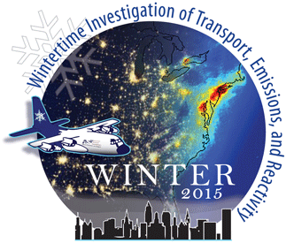
WINTER, mid-Atlantic. The large majority of field intensives in polluted regions have focused principally on understanding emissions, transformation and transport in warmer conditions. The Wintertime INvestigation of Transport, Emissions, and Reactivity (WINTER) study provides detailed, aircraft-based measurements to address the seasonality of these processes. The NSF C-130 is based in the mid-Atlantic region over six weeks in January - February 2015. Flights take place on scales ranging from investigations of local sources (urban, power plant, agricultural) to longer-range transport. Results critically inform atmospheric chemical models for ozone, aerosols and a variety of other primary and secondary pollutants. More Info
Agricultural Emissions Studies, Colorado Eastern Plains. Researchers are carrying out source studies using an instrumented van to measure emissions of major nitrogen-containing species, methane, and other gases simultaneously. These measurements are necessary to attribute emissions to specific sources and to identify the best agricultural management practices to minimize emissions to the air. The agricultural emissions studies in 2016 use our mobile laboratory along with an instrumented light aircraft. More Info
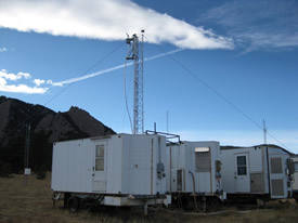
FRAPPÉ / DISCOVER-AQ, Colorado Front Range. The NSF sponsored Front Range Air Pollution and Photochemistry Éxperiment (FRAPPÉ) and the NASA sponsored Deriving Information on Surface conditions from Column and Vertically Resolved Observations Relevant to Air Quality (DISCOVER-AQ) mission take place in Summer 2014. Three aircraft, including the NASA P-3 and King Air and the NSF / NCAR C-130 make observations characterizing the local to regional chemical environment including photochemistry, oxidant and aerosol formation and fate, flow and recirculation patterns and large-scale inflow. Instruments at the Boulder Atmospheric Observatory (BAO) tower provide both ground-based measurements and vertical profiles of a suite of compounds that contribute to aerosol and ground level ozone. More Info
CARE-Beijing, China. CARE-Beijing (Campaigns of Air Quality Research in Beijing and Surrounding Regions) is an international air quality study in 2014 focused on understanding the transport and transformation process of air pollution in Beijing and the surrounding North China Plain. CSD deployed a cavity enhanced spectrometer to the ground site at Wangdu in collaboration with Peking University and Georgia Institute of Technology, to measure key sources of atmospheric oxidants that participate in photochemical reactions producing harmful secondary pollutants, such as ozone and particulate matter. More Info
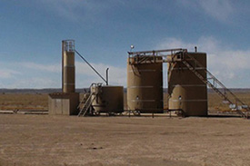
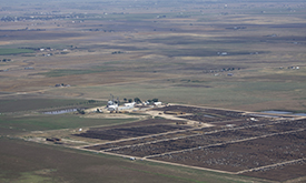
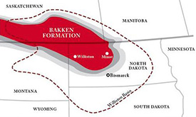
TOPDOWN, North Dakota, Colorado, New Mexico. Twin Otter Projects Defining Oil/gas Well emissioNs (TOPDOWN) aims to understand the atmospheric impact of rapidly expanding oil and gas operations in the Bakken play in North Dakota. Subsequent flights also examine the Denver-Julesburg basin in NE Colorado, and the San Juan basin in New Mexico. Instruments integrated aboard the NOAA Twin Otter aircraft measure key atmospheric trace gases (CO2, CO, CH4, C2H6, O3, and many more) along with black carbon. More Info
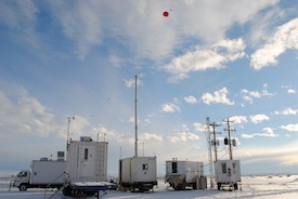
E&E UBWOS, Horse Pool, Utah. The Energy and Environment - Uintah Basin Winter Ozone Study (E&E UBWOS) was designed to study the causes of high wintertime ozone observed in the Uintah Basin. Scientists constructed a ground site of instruments in the winters of 2012, 2013, and 2014 to study sources of VOCs, NOx and particles, ozone formation chemistry in areas of enhanced UV radiation from snow cover, unique radical sources (HONO, CH2O, ClNO2) and the role of transport. More Info
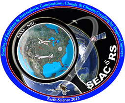
SEACR4S, Houston, Texas. Studies of Emissions and Atmospheric Composition, Clouds and Climate Coupling by Regional Surveys (SEAC4RS) is based out of Ellington Field in August - September 2013. Focused on pollution emissions and the evolution of gases and aerosols in deep convective outflow, and the influences and feedbacks of aerosol particles from anthropogenic pollution and biomass burning on meteorology and climate, the project requires two aircraft to accomplish the goals. The NASA DC-8 provides observations from near the surface to 12 km, and the NASA ER-2 provides high altitude observations reaching into the lower stratosphere as well as important remote sensing observations connecting satellites with observations from lower flying aircraft and surface sites. More Info
SENEX, Southeast U.S. The goal of the Southeast Nexus (SENEX) 2013 program is to study the interactions between natural and anthropogenic emissions in the southeast at the nexus of the air quality and climate change. Scientists quantify the emissions of greenhouse gases and aerosol, and investigate the roles played by anthropogenic and natural emissions in the formation of ozone and aerosol in the atmosphere. This airborne study involves the NOAA WP-3D aircraft, forecast modeling and surface monitoring networks. More Info
SONNE, Erie, Colorado. Summer Ozone Near Natural gas Emissions (SONNE) was designed to examine the effects of photochemical processing and characterize the gas-phase composition in the vicinity of oil and natural gas production in Wattenberg Field of the Denver-Julesburg Basin during the summertime in 2012. Scientists constructed a ground site of instruments to study VOC emissions and gas-phase composition of the ambient air. More Info
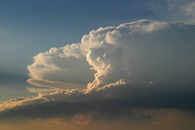
DC3, Salina, Kansas. The Deep Convective Clouds & Chemistry (DC3) experiment investigates the impact of deep, midlatitude continental convective clouds, including their dynamical, physical, and lightning processes, on upper tropospheric composition and chemistry. Airborne measurements taken from the NASA DC-8 in July 2012 provide in situ observations to characterize the convective storm inflow and provide remote sensing to aid in flight planning and column characterization. More Info
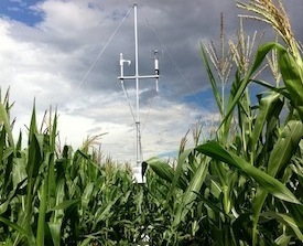
BioCORN, Ft. Collins, Colorado. The primary goals of the 2011 Biofuel Crops emission of Ozone pRecursors iNtensive (BioCORN) were to discover the dominant VOCs from biofuel crops, the likely oxidation products, and the total aerosol and ozone forming potential. To help meet these goals, scientists set up a ground site with several instruments to measure the emissions of a corn field. Corn is the largest biofuel crop in the U.S. for ethanol production. Most of the gasoline sold in the U.S. is E10 which means it contains 10% ethanol, mainly produced from corn. Furthermore, there is little information on VOC emissions in literature from corn. More Info
NACHTT, Erie, Colorado. The primary goal of Nitrogen, Aerosol Composition, and Halogens on a Tall Tower (NACHTT) is to understand why and how a compound usually associated with the atmosphere near oceans – nitryl chloride (NO2Cl) – also forms during the winter nighttime in land-locked regions. NO2Cl breaks apart quickly as the sun rises to release chlorine atoms. Chlorine atoms can react with many other compounds, contributing to smog formation, and can also influence chemical cycles that destroy or produce various greenhouse gases, including ozone and methane. Studies commence February - March 2011 to assess these implications for both climate and air quality. More Info
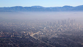
CalNex, Southern California. The goal of the California Research at the Nexus of Air Quality and Climate Change (CalNex) 2010 program is to study the important issues at the nexus of the air quality and climate change problems, and to provide scientific information regarding the trade-offs faced by decision makers when addressing these two inter-related issues. The NOAA WP-3D aircraft, the R/V Atlantis ship, and several ground sites were involved in this project. Comprehensive data analysis followed the completion of this project in July 2010. More Info
FireLab, Missoula, Montana. Forest fires are a large source for pollutants in the atmosphere and one of the important issues for air quality and climate change. The goal of this 2009 study was to quantify the atmospheric source of organic and inorganic trace gases from forest fires and to assess their potential to contribute to aerosol and ozone formation. The fire emissions of various fuels from the south-eastern and south-western U.S. were quantified and compared. More Info
Kohler Mesa, Boulder, Colorado. Halogens play several important roles in the Earth's atmosphere, influencing ozone levels and affecting rates of VOC oxidation. Yet both the magnitude and the identity of halogen sources remain highly uncertain, particularly in the troposphere. NOAA researchers have discovered a mechanism for release of halogens from halide containing aerosols that is linked to NOx pollution. This mechanism was originally thought to be important only in coastal or marine environments where sea salt aerosol provides a source of aerosol chloride. The aim of this 2009 study was to determine the extent to which such chemistry is also active over mid-continental areas. Results provide new insight into the efficiency of tropospheric halogen production. More Info
ARCPAC, Fairbanks, Alaska. As part of the International Polar Year of 2008, NOAA engaged in an airborne field measurement campaign targeted at improving understanding climate-relevant processes. The Aerosol, Radiation, and Cloud Processes affecting Arctic Climate (ARCPAC) effort was focused on direct measurements of properties and processes that can be used to reduce uncertainty in radiation and climate models. The measurements were made in the Alaskan Arctic to closely coordinate with remote-sensing and in situ observations from aircraft and ground sites in the vicinity of Barrow, Alaska. More Info

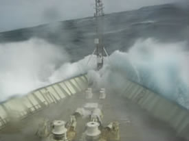
ICEALOT, Greenland, Norwegian and Barents Seas. As part of the International Polar Year of 2008, NOAA engaged in field measurements using the R/V Knorr in the ice-free regions of the Greenland, Norwegian, and Barents Seas. The International Chemistry Experiment in the Arctic LOwer Troposphere (ICEALOT) addresses scientific issues including springtime sources and transport of pollutants to the Arctic, evolution of aerosols and gases into and within the Arctic, and climate impacts of haze and ozone in the Arctic. More Info
BAO, Erie, Colorado. The Boulder Atmospheric Observatory (BAO) 2008 project is a short-term informal, collaborative study linking air quality and climate goals in an urban area in the proximity of complex terrain. This project temporarily enhances NOAA Carbon Cycle long-term measurements with an additional suite of anthropogenic pollution measurements. This study overlaps with test flights of ESRL remote-sensing instrumentation on the NOAA Twin Otter in the Colorado Front Range region. More Info
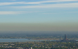
TexAQS 2006, Houston, Texas. This intensive field study focused on providing a better understanding of the sources and atmospheric processes responsible for the formation and distribution of ozone and aerosols in the atmosphere and the influence that these species have on the radiative forcing of climate regionally and globally, as well as their impact on human health and regional haze. The Texas Air Quality Study (TexAQS) area included Texas and the northwestern Gulf of Mexico in the summer of 2006. This project used the NOAA WP-3D and the R/V Ronald H. Brown as research platforms. More Info