CalNex TOPAZ Lidar data
July 17 - Preliminary Data
| Previous Flight | Archive Calendar | Next Flight |
|---|
Flight #45: Survey pollution in the LA Basin
Flight level: 500 AGL - 10500 MSL
Takeoff : 09:30 PST
Duration : 3:30 h
Objective : Map pollution in the LA Basin, and characterize export of pollutants through Cajon & Banning Pass and over mountain ridges.
Select an image to view full resolution
Ozone in Google Earth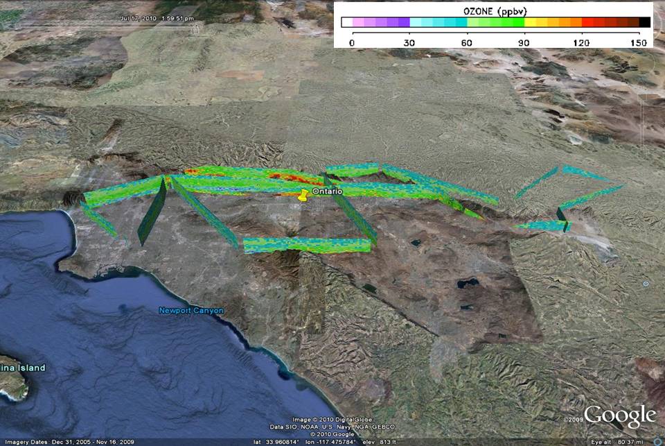 Get the Google Earth kml file |
Ozone Cross-section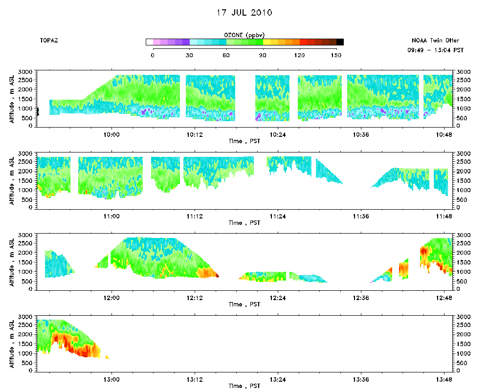 Download the ASCII file |
|---|