TexAQS 2006 TOPAZ Lidar data
September 8 - Final Data
| Previous Flight | Archive Calendar | Next Flight |
|---|
Flight #21
Takeoff: 10:08 CDT
Total flight time: 6.0 hours
The objectives of this Twin Otter flight were to a) characterize import of ozone and aerosol pollutants into the state of Texas under easterly flow conditions and b) to sample locally generated pollution plumes in the Tyler/Longview and Dallas/Fort Worth urban areas. The Twin Otter started sampling just offshore south of Port Arthur and then proceeded north along the Texas-Louisiana border. Background ozone values measured by the Twin Otter along the border were around 80 ppb. About 20 nm north of I-20, the Twin Otter turned west towards the Dallas/ Fort Worth area. By then, Cu clouds were increasing significantly, hampering the Twin Otter lidar operation. Therefore, it was decided to abort the second part of the mission (sampling of Dallas/Fort Worth area) and return to Houston. Despite cloudy conditions, sampling of background ozone and aerosol conditions was continued on the way back to Houston.
Select an image to view full resolution
Ozone Cross-section download ICARTT format data (ict file) download simple ASCII data (txt file) |
Aerosol Cross-section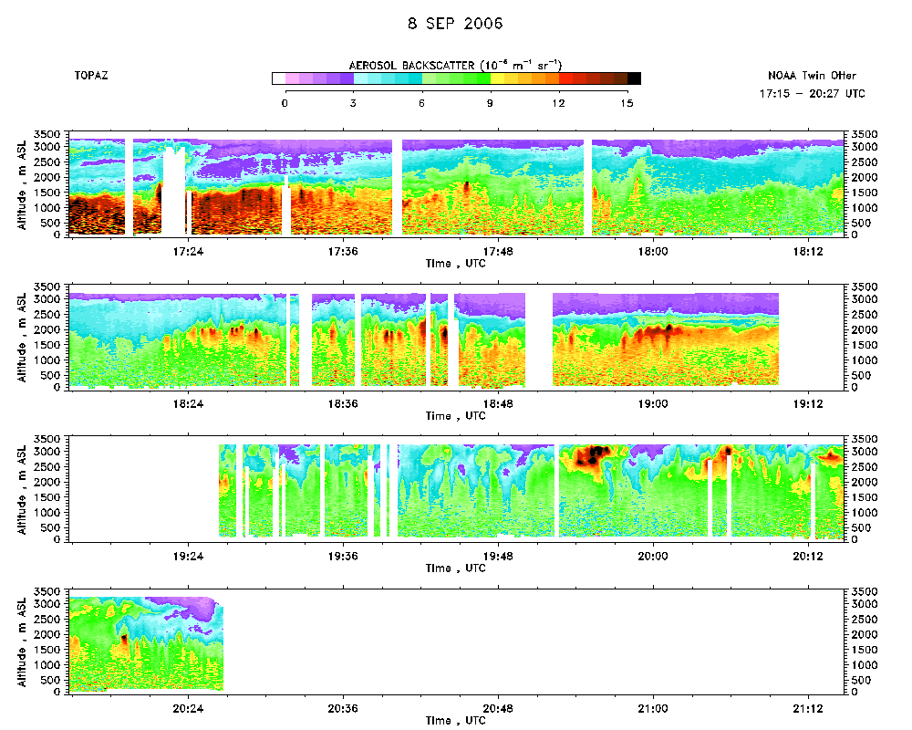 download ICARTT format data (ict file) download simple ASCII data (txt file) |
Ozone Map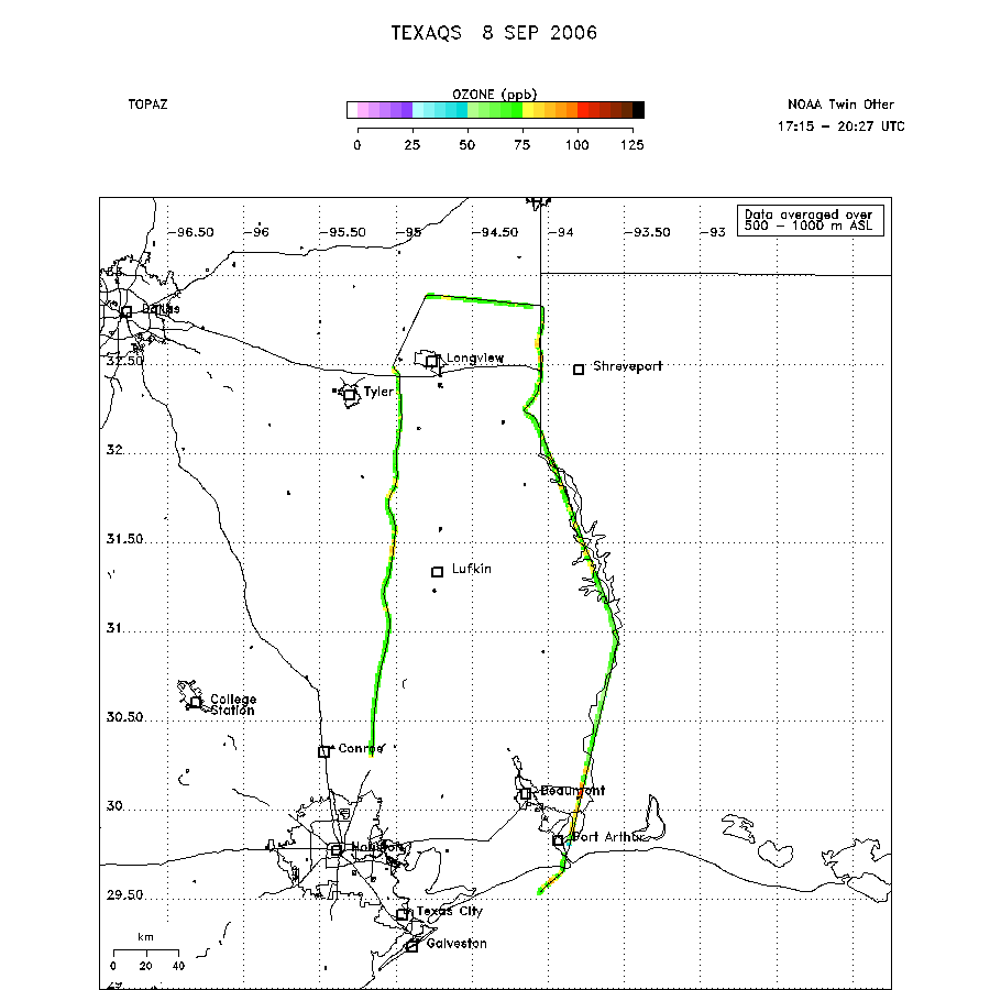 |
Mixed Layer Height Map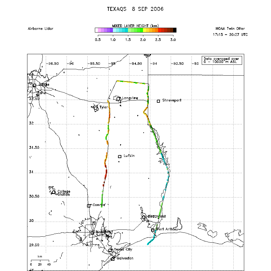 download ICARTT format data (ict file) download simple ASCII data (txt file) |