TexAQS 2006 TOPAZ Lidar data
September 7 - Final Data
| Previous Flight | Archive Calendar | Next Flight |
|---|
Flight #20
Takeoff: 10:17 CDT
Total flight time: 7.0 hours
This Twin Otter flight addressed multiple objectives. The flight plan was developed to put the Twin Otter directly beneath the MISR High Resolution Area. Three extended legs were flown in collaboration with the NASA King Air. Data gathered during these legs will be used to investigate the effectiveness of MISR algorithms in estimating aerosol properties over land surfaces, and to examine the information content of retrievals of aerosol properties from multi-wavelength lidar data. A direct comparison with an ozone sonde launched from the Ron Brown at Jacinto Point was obtained at 11:50 AM. The ozone and aerosol measurements commenced over the Gulf southeast of Galveston Bay, and were extended to north of Houston prior to the Ron Brown comparison. After the ozone sonde comparison the Twin Otter flew to the southwest of Houston, then to the northwest directly over the surface flux stations at Brenham and Kirbyville. While northwest of Houston, the Twin Otter sampled ozone and aerosol near the Louisiana border upwind of Houston. On the return to Houston, an upwind leg was sampled over Galveston Bay, followed by a north-south leg approximately over the ship channel extending to the Gulf. High ozone values and mixing layer depths were observed west of the bay region, while the mixing height over Galveston Bay was lower. During the flight, some evidence of cloud venting of ozone may have been observed. Several smoke layers were observed by the lidar at different altitudes below flight level at various locations along the flight track.
Select an image to view full resolution
Ozone Cross-section download ICARTT format data (ict file) download simple ASCII data (txt file) |
Aerosol Cross-section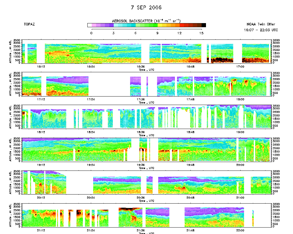 download ICARTT format data (ict file) download simple ASCII data (txt file) |
Ozone Map |
Mixed Layer Height Map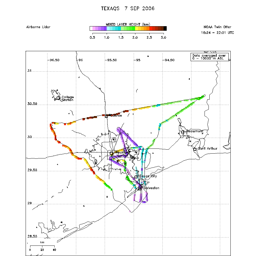 download ICARTT format data (ict file) download simple ASCII data (txt file) |