TexAQS 2006 TOPAZ Lidar data
September 13 - Final Data
| Previous Flight | Archive Calendar | Next Flight |
|---|
Flight #22
Takeoff: 12:20 CDT
Total flight time: 6.5 hours
The Twin Otter flew a mission in the Dallas area in concert with the NOAA P3 and the NASA King Air. The Twin Otter collected ozone and aerosol profile data over and downwind of the Dallas/Fort Worth area. Ozone values in the Dallas/ Fort Worth plume were about 80 - 90 ppb, compared to a background of ~ 60 ppb. Sampling during one of the legs downwind of Dallas/Fort Worth was closely coordinated with the NOAA P3 and NASA King Air aircraft, providing a good opportunity for comparison of the measurements from the various platforms. On the return leg to Houston, the Twin Otter intercepted the pollution plumes from several large power plants in the area southeast of Dallas/Fort Worth.
Select an image to view full resolution
Ozone Cross-section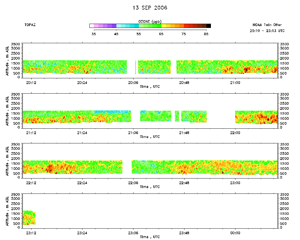 download ICARTT format data (ict file) download simple ASCII data (txt file) |
Aerosol Cross-section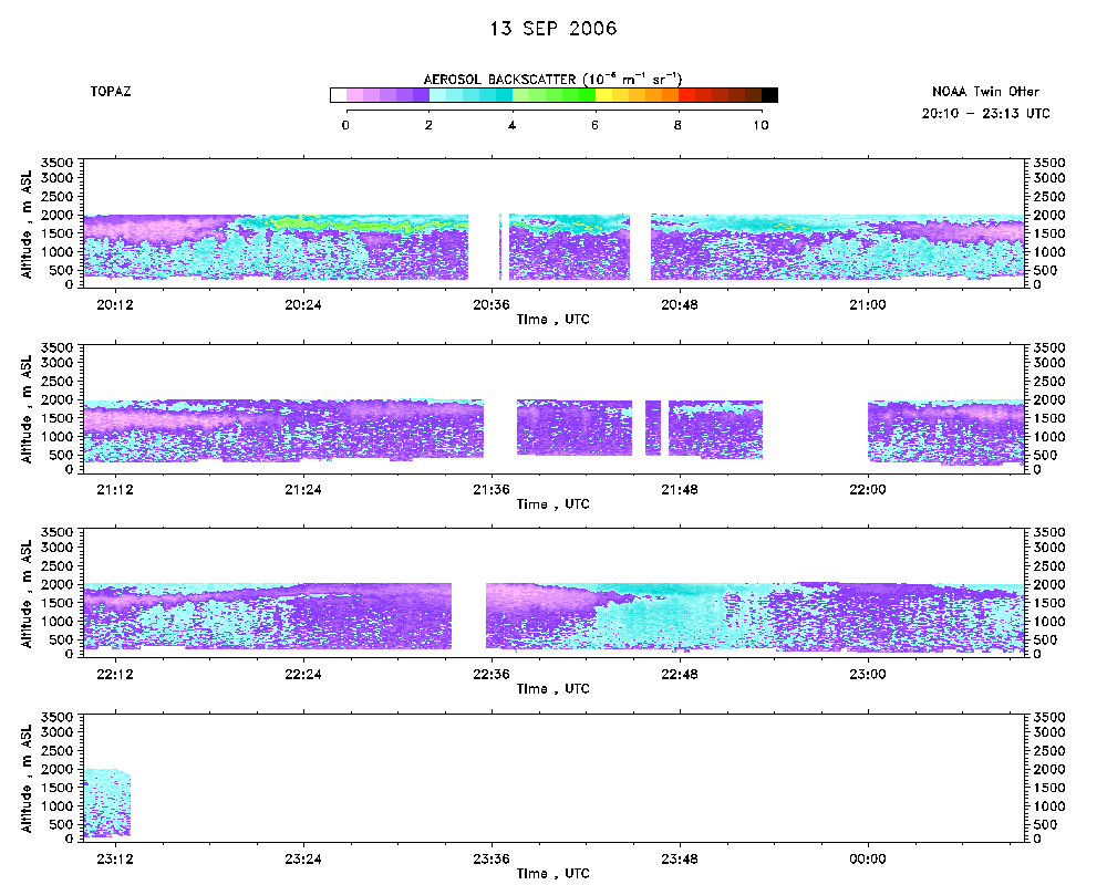 download ICARTT format data (ict file) download simple ASCII data (txt file) |
Ozone Map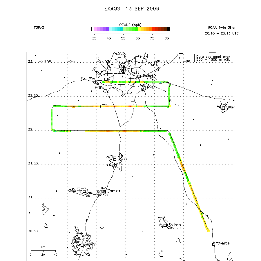 |
Mixed Layer Height Map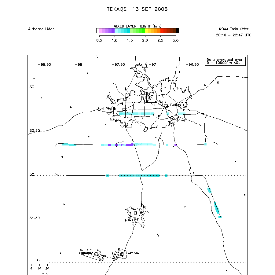 download ICARTT format data (ict file) download simple ASCII data (txt file) |