TexAQS 2006 TOPAZ Lidar data
September 4 - Final Data
| Previous Flight | Archive Calendar | Next Flight |
|---|
Flight #19
Takeoff: 11:54 CDT
Total flight time: 4.2 hours
Science objectives for this flight were aimed at characterizing the transport of pollution eastward into Texas from the Louisiana border and under-flying the CALIPSO track concurrent with the NASA King Air. North-south transects were made east of the Texas-Louisiana border, between Beaumont-Port Arthur and Houston, and west of Houston. On the easterly transect, plumes from fires were observed to be transported primarily to the south, likely precluding the possibility that the plumes would be transported directly to the Houston area. Interesting aerosol structure was observed near the Lousiana coast: an elevated aerosol layer aloft with relatively clean air below occurred over the Gulf. At the coast, however, this changed to higher aerosol near the surface with clean air aloft (outside of fire plumes). High aerosol scattering was observed by the lidar and confirmed visually on the second transect. With the exception of an isolated plume in Louisiana and a plume observed over the Gulf near the mouth of Galveston Bay, low ozone was observed on the first two transects. On the last east-west transect west of Houston, clouds and convection prevented underflight of the CALIPSO track. The track was extended to 30 degrees north, then repeated to the south to recover data lost during a brief computer glitch (raw data were not written during this segment). A plume originating from either Texas City or Chocolate Bayou was observed at the southern end of the leg.
Select an image to view full resolution
Ozone Cross-section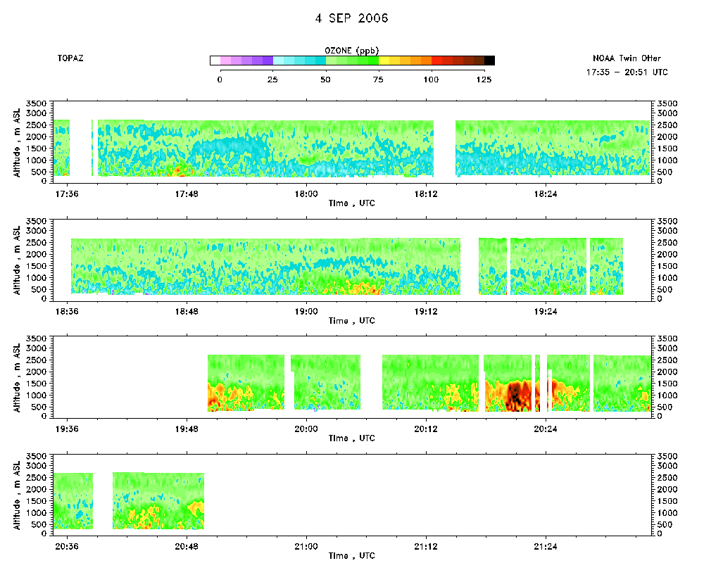 download ICARTT format data (ict file) download simple ASCII data (txt file) |
Aerosol Cross-section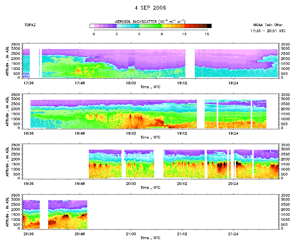 download ICARTT format data (ict file) download simple ASCII data (txt file) |
Ozone Map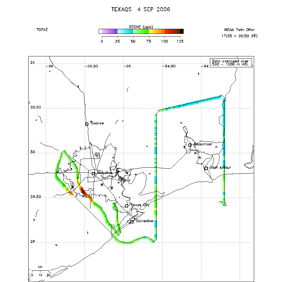 |
Mixed Layer Height Map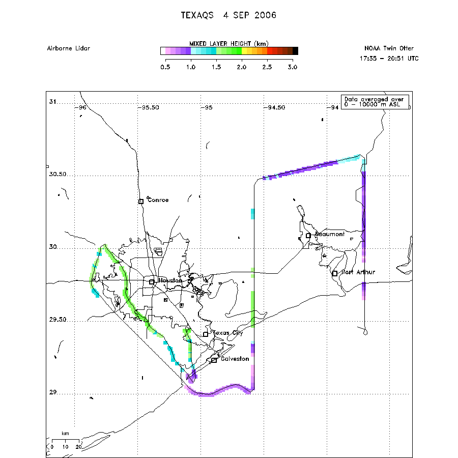 download ICARTT format data (ict file) download simple ASCII data (txt file) |