![[NOAA]](../img/noaa.gif) ![[ETL]](../img/etl.gif) |
|
|
Daily Nauru99 Report NOAA Ship RONALD H. BROWN Previous <- 7/14/99 -> Next
Time:1445 Local, 0245 Z
Visual Observations:One of the most pleasant days of the campaign - gentle breezes and seas, multi-layered but sparse clouds. Notable Events and Anecdotes:We began the day expecting to circumnavigate the island continuously at 1 km offshore, with no scheduled RHIB runs. However, by noon we had already made 2 runs and had another 2 scheduled - mostly visitors from Nauru (including a media team). Instrument Status:This is the last day for DIAL and HRDL lidar observations. They will be broken down and packed starting tomorrow |
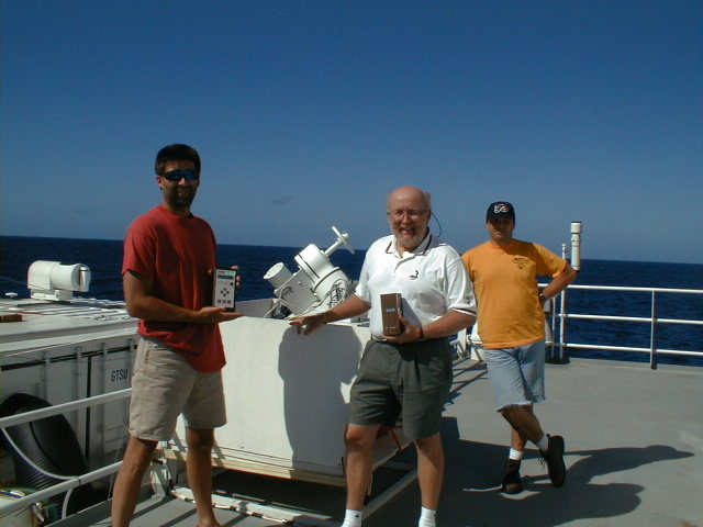
Scott Smith (BNL), Tom Gillman (College of Desert), and Chuck Pavloski (PSU) doing a sun phometry gig on RHB's 03 deck (forward). Also shown are two hand-held sun photometers (Microtops and CMDL versions) and the Penn State ship-stabilized sun photometer. This type of thing happens frequently. |
| NOAA |
ETL |
Nauru 99 |
Webmaster Updated: June 1999 |
|