E&E - UBWOS 2014 Location
Ground site at Horsepool, UT – 40.14370°N, 109.46718°W
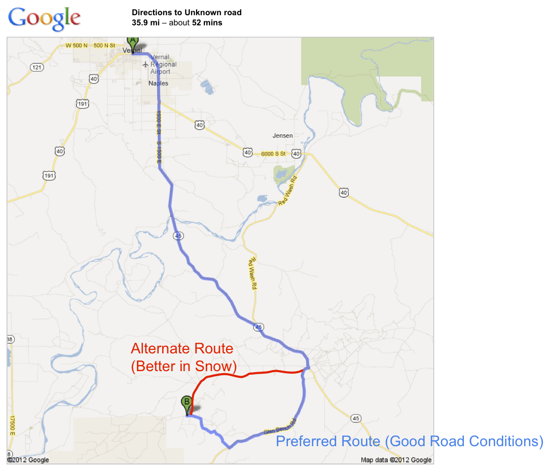
Driving map for directions to field site. Select map to view larger image. Download driving map and directions ![]()
Travel / Lodging
Vernal, UT population ~ 9,000
- ~ 6 hrs by car from Denver/Boulder
- 1-2 flight/day from Denver
- ~ 3 hrs by car from Salt Lake City
- 45-60 minutes to Horsepool (depending on road conditions)
| Directions from Vernal to Horsepool field site | Distance |
|---|---|
| 1. Head north on S Vernal Ave toward W Main St | go 72 ft total 72 ft |
| 2. Take the 1st right onto US-40 E/E Main St Continue to follow US-40 E About 7 mins |
go 4.0 mi total 4.0 mi |
| 3. Turn right onto UT-45 S About 21 mins |
go 20.3 mi total 24.3 mi |
| 4. Turn right toward Glen Bench Rd About 3 mins |
go 1.1 mi total 25.4 mi |
| 5. Continue straight onto Glen Bench Rd About 12 mins |
go 6.8 mi total 32.2 mi |
| 6. Turn right at 4 way intersection (leaving tarmac onto gravel) on Chuck Massey Ave. About 4 mins |
go 1.4 mi total 33.6 mi |
| 7. Turn left About 4 mins |
go 1.4 mi total 35.0 mi |
| 8. Slight left Destination will be on the left About 3 mins |
go 0.8 mi total 35.9 mi |
Horsepool drill pad is 1.5 miles east of the QEP Wonsits Valley Office on County Rd 3250, also called Wonsits Valley Rd.

Google Earth™ image of road to Horsepool. Select to view larger image.
Shipping
Ship packages to:
Energy Dynamics Laboratory
c/o Scott Hill, NOAA/UBWOS
Bingham Energy Research Center
320 North Aggie Blvd.
Vernal, UT 84078
Please alert Scott if you have sent a package: (435) 722-1773