'96 Tropical Air-Sea Interaction Campaign: Combined Sensor Program
We want to understand better what causes climate, and climate to change. Tropical oceans are an extremely important part of the puzzle, and one we are only beginning to understand.
The ocean/atmosphere system has many positive and negative feedbacks between incoming and outgoing radiation, aerosols, clouds, water vapor, winds, and currents. A change in one causes a change in several others, which in turn cause further changes. This cascading continues until a balance is reached (or not!).
The daily events that bring about the balance are called weather. The balance itself is called climate. The balance may be very stable or it may be delicate, depending on the nature of the inter-relationships. Before we can predict what man or nature will do to the balance, we must better understand the inter-relationships and feedback mechanisms.
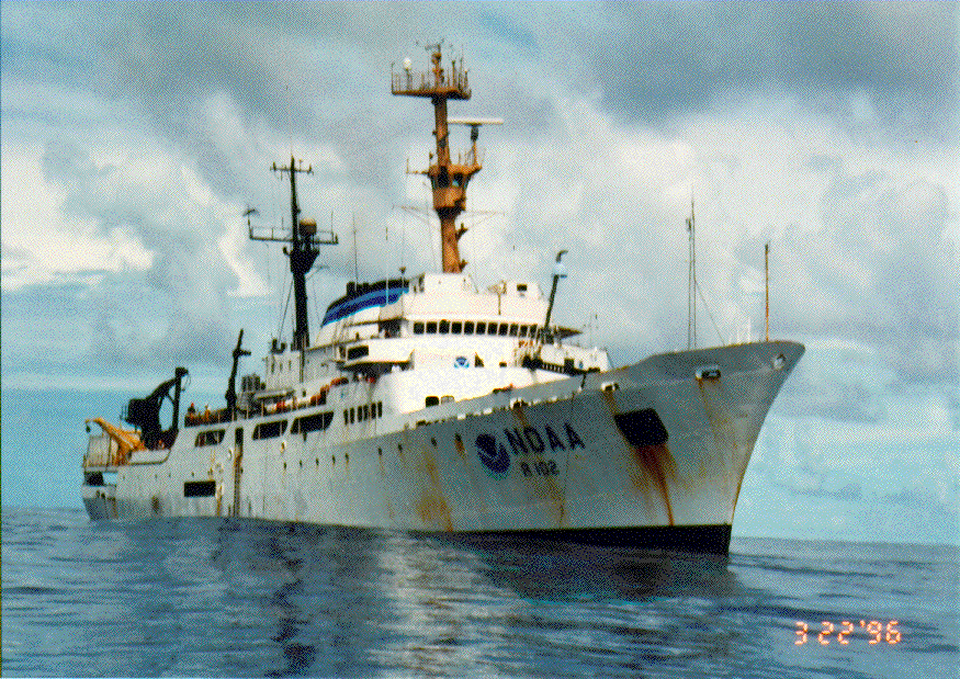
NOAA Research Ship Discoverer
CSP
The Combined Sensor Program (CSP) is the first comprehensive single-platform mission in a tropical marine environment to attempt to measure all the known factors simultaneously. The mission onboard NOAA's Research Vessel Discoverer began March 14, 1996 in Pago Pago, American Samoa, included ten days near Manus Island, Papua New Guinea, and ended in Honolulu, Hawaii. With this single campaign we do not expect to completely characterize the inner workings of nature's climate engine, but we do expect to gain valuable insight to at least a few of the important ones in this climatically important region (the "warm pool", where El Nino originates).
A manuscript describing the CSP mission has been written and accepted to the Bulletin of the American Meteorlogical Society. It gives several examples of preliminary results, and lists many references for the measurement techniques that were used on the mission. We expect the paper to appear in the December issue.
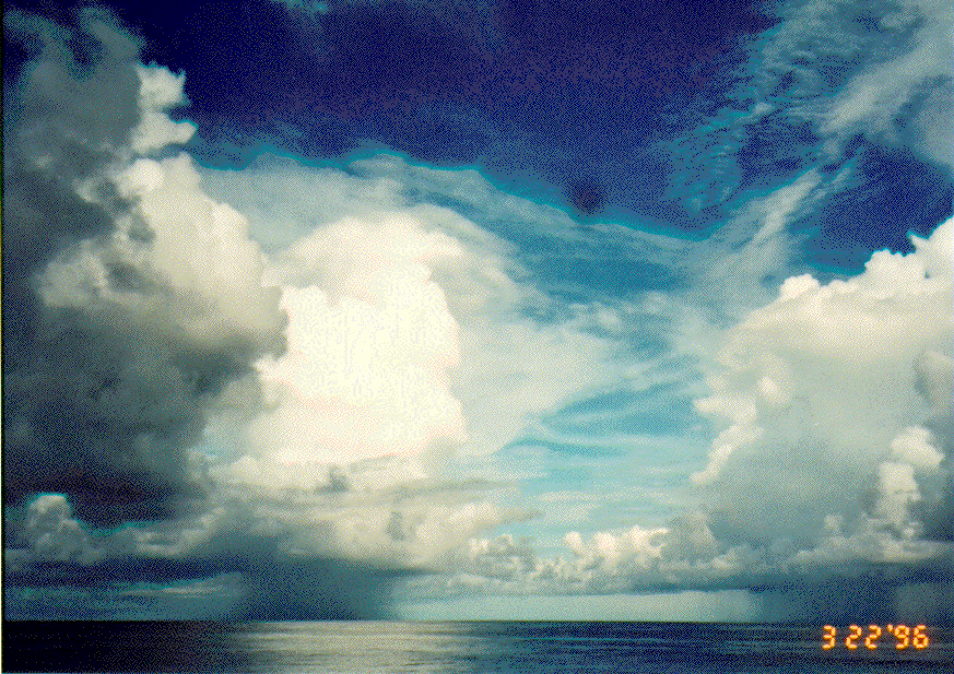
Clouds 100km NW of Manus Island
DOE and NOAA Partnership
The Department of Energy (DOE) has established a ten-year research program at several globally-representative sites to study climate processes -- the Atmospheric Radiation Measurement (ARM) program. The instruments and investigations at the sites will be very similar to those on the CSP mission. In an informal partnership, NOAA has provided the platform (Discoverer) and DOE has provided support to ten government and university organizations for the scientific work onboard. This NOAA/DOE partnership benefits both agencies. Both will gain valuable new knowledge on the mechanics of the climate engine in a tropical marine environment. DOE will be able to validate its new climate research instrumentation on Manus Island, Papua New Guinea, and assess the effect of large nearby land masses (if any) on the observations it makes there. And NOAA can use the datasets to better understand and mitigate atmospheric interferences to its satellite sensors that attempt to measure similar processes. The resultant parameterization of climate processes will also be used to improve general circulation models (GCMs). NOAA is proposing to ARM to deploy a similar set of instruments on R/V Ron Brown for a 30-day mission in 1999 in the vicinity of Naura Island in the central Pacific, site of another DOE TWP CART facility. NASA MTPE instrument teams may join this campaign.
Area Studied, Methodology
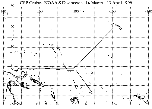
Discoverer's nominal course during the CSP cruise.
We loaded scientific equipment onto Discoverer beginning March 12 in Pago Pago, American Samoa (14.28° S, 170.68° W), and left port late March 14. Discoverer steamed NW to 2° S, 180° W, then generally west between 1° and2° S until we reached the vicinity of Manus Island (2° S, 147.3° E). This 5-day leg comprised the first half of a 32° (3200 km) meridional survey of the Pacific warm pool. Next we held stations for 2 days each approximately 100 km NE of the DOE site on Manus Island, 30 km NE, and a few kilometers offshore. On leaving Manus Island we repeated station-keeping at the same two outer positions for another 48 hours apiece. Therefore the total time spent near Manus Island was ten days, and our station-keeping was time- and distance-symmetric. From the last 100 km station Discoverer steamed east along 1° S until we reached the dateline (180° W), statistically sampling the equatorial warm pool for another 6 days. Finally we steamed NE to conclude the mission at Pearl Harbor, Hawaii (21.3° N, 157.92° W). Although we crossed the dateline, the Discoverer remained exclusively on western hemisphere time throughout the mission. Scientific operations were conducted strictly on Universal (Greenwich) Time to avoid confusion.
Instruments
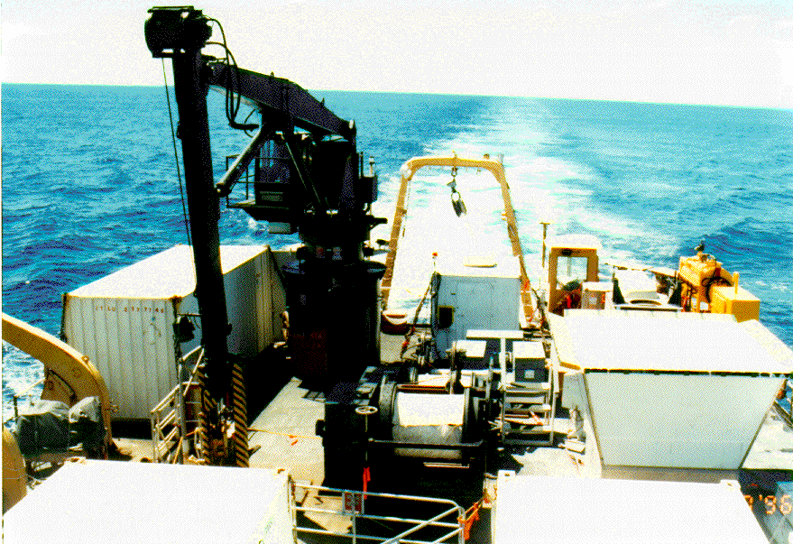
Discoverer's stern showing several of the instruments that were part of the CSP mission
Instruments involved in CSP included GPS positioning, acoustic current probes, radiosondes (4-8 daily), ceilometer, radar wind profiler, surface flux system (heat, momentum, humidity), cloud profiling radars, vertical and scanning Fourier Transform Infrared Radiometers (FTIRs), microwave radiometers, elastic and Raman lidars, in-situ aerosol samplers, Sea Surface Temperature (SST) sensors, all-sky camera, AVHRR satellite receiver, sun photometers, infrared/visible portable radiation package, rain sensors, surface meteorological sensors, and a heat flux buoy.
Workshop, Conferences, Journal Article
A workshop to examine the datasets and to plan collaborative research was held in Boulder October 28-29, 1996. An article describing CSP has been prepared for the Bulletin of the American Meteorological Society.