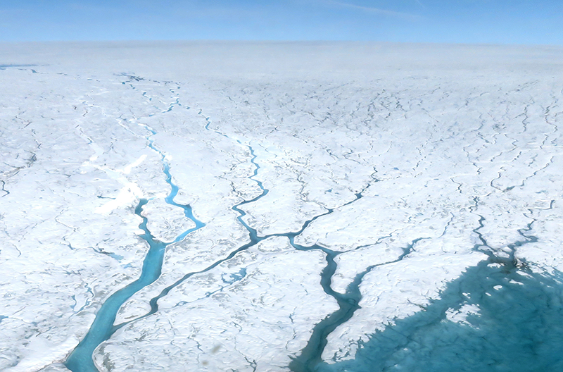
Cloud-Atmospheric Boundary Layer-Surface Interactions on the Greenland Ice Sheet during the July 2012 Extreme Melt Event
The Greenland Ice Sheet (GIS) is the second largest body of ice on Earth, after the Antarctic ice sheet. Observations from the late 20th century indicate that summer melt has accelerated on the GIS, most notably along coastal regions. If this melting moves to higher elevations of the GIS it will further impact climate around the world causing more rapid sea level rise and altering ocean circulations. It is therefore critically important to understand the processes that may cause melting of the central GIS.
In a new study, to be published in the May issue of the Journal of Climate, CIRES researchers in the Physical Sciences Laboratory used a regional Weather Research Forecast model to investigate the role of clouds in the recent extreme melt event of July 2012—where over 90 percent of the GIS surface experienced melting. This melt occurred even at the top of the ice sheet, which previously experienced melting 126 years earlier, in 1889. The 2012 event was characterized by a warm, moist air mass, which was transported northward along the west coast of Greenland and then up over the top of the GIS. However, as this study demonstrates, it is only through the additional warming effect of the low-level clouds that the extreme melting occurred over much of the central GIS.
At the time of the extreme melt event, satellites detected stratocumulus clouds over the GIS. These low-level cloud systems are consistently found in the area and play a unique role in regional climate, producing a surface warming effect over the central GIS even during periods of maximum incoming solar radiation. The findings of this modeling study indicate that beyond their direct radiative effect, these cloud systems impact the Greenland climate by modifying the properties of the ice sheet, the atmospheric structure, and the surface fluxes. Most notably, this study demonstrates that melting would not have occurred without preconditioning of the snowpack by cloud feedbacks previous to the extreme event, highlighting the sensitivity of the Greenland climate to the integrated impacts of clouds.
The fate of the Greenland Ice Sheet will have global impacts. For example, if the entire GIS melts, sea level is predicted to rise by up to 7 meters, thereby increasing flooding of coastal land and causing saltwater intrusion into groundwater. In addition, an increase in freshwater runoff will impact ocean circulations globally and cause regional impacts, such as additional sea level rise in the northeast coast of the United States. Better understanding of the coupling between clouds and the ice sheet is necessary to improve models and predictions so that, if needed, future planning and mitigation can be addressed.
Posted: April 27, 2017

Authors of Cloud-Atmospheric Boundary Layer-Surface Interactions on the Greenland Ice Sheet during the July 2012 Extreme Melt Event are Amy Solomon, Matthew Shupe, and Nathaniel Miller of the ESRL Physical Sciences Laboratory.