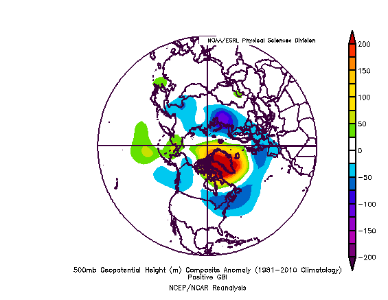
Greenland Blocking Index (GBI)
- Description:
- A measure of blocking over Greenland.
- Image:
- Calculation Method:
- 500mb geopotential height area averaged 60-80N, 280-340E from the daily averaged NCEP/NCAR Reanalysis (0,6,12 and 18Z).
- Time Interval: Daily
- Time Coverage: 1948-near present
- Update Status: irregular
- Get Data:
- Update Status: irregular
-
GBI Timeseries Units: meters
- Source:
- Index is calculated at NOAA/ESRL PSL.
- References/Info:
- Hanna, E. J. Jones, J. Cappelen, S.H. Mernild, L. Wood, K. Steffen and P. Huybrechts: The influence of North Atlantic atmospheric and oceanic forcing effects on 1900–2010 Greenland summer climate and ice melt/runoff. 30 March 2013. International Journal of Climatology. 33, Issue 4, 862–88.
- Related Timeseries:
- A monthly index will be available.
- A daily and monthly GBI from the 20th Century Reanalysis will be available.
Postive sign of GBI: