
The Wind Forecast Improvement Project in Complex Terrain (hereafter WFIP2) has two overarching scientific goals:
The participants in WFIP2 are conducting a field campaign to assess how physical processes alter wind speeds across the rotor diameter. From this research, the team will work to develop physical modeling schemes or atmospheric theories that can be incorporated in foundational weather models to improve wind forecasting (http://www.esrl.noaa.gov/gsd/renewable/wfip2.html).
NOAA GRAD’s role is to evaluate the surface radiation budget, aerosols, and clouds in different meteorological regimes representative of complex terrain in the Columbia River Valley.
The surface radiation budget is the difference between the downward and upward components of shortwave (SW) and thermal infrared longwave (LW) radiation. Solar and infrared radiation are modulated by atmospheric conditions including clouds and aerosols. The reflected solar and the upwelling longwave radiation are in part determined by the land surface type and moisture availability. The sum of the incoming and outgoing radiative components at the surface constitutes the net radiation or net absorbed energy available for the transport of sensible heat and water vapor into the atmosphere and storage of heat in the ground. It also drives many of the complex processes of vegetated surfaces such as photosynthesis. This net radiation is the bulk of the energy available for atmospheric dynamic processes.
The integrated observation/model data set will provide the basis for exploring radiative impacts of aerosols and cloud formation on atmospheric processes. What is the temporal variability of surface radiation that drives meteorological processes and feedback on cloud formation? What is the role of radiation, surface albedo, aerosols, and clouds in meteorological regimes representative of complex terrain in the Columbia River Valley? Statistical correlations between the observations and meteorological regimes that determine the planetary boundary layer height and wind flow characteristics will be investigated and compared with NWP models (HRRR/RAP).
We are interested in the following questions through retrospective studies:
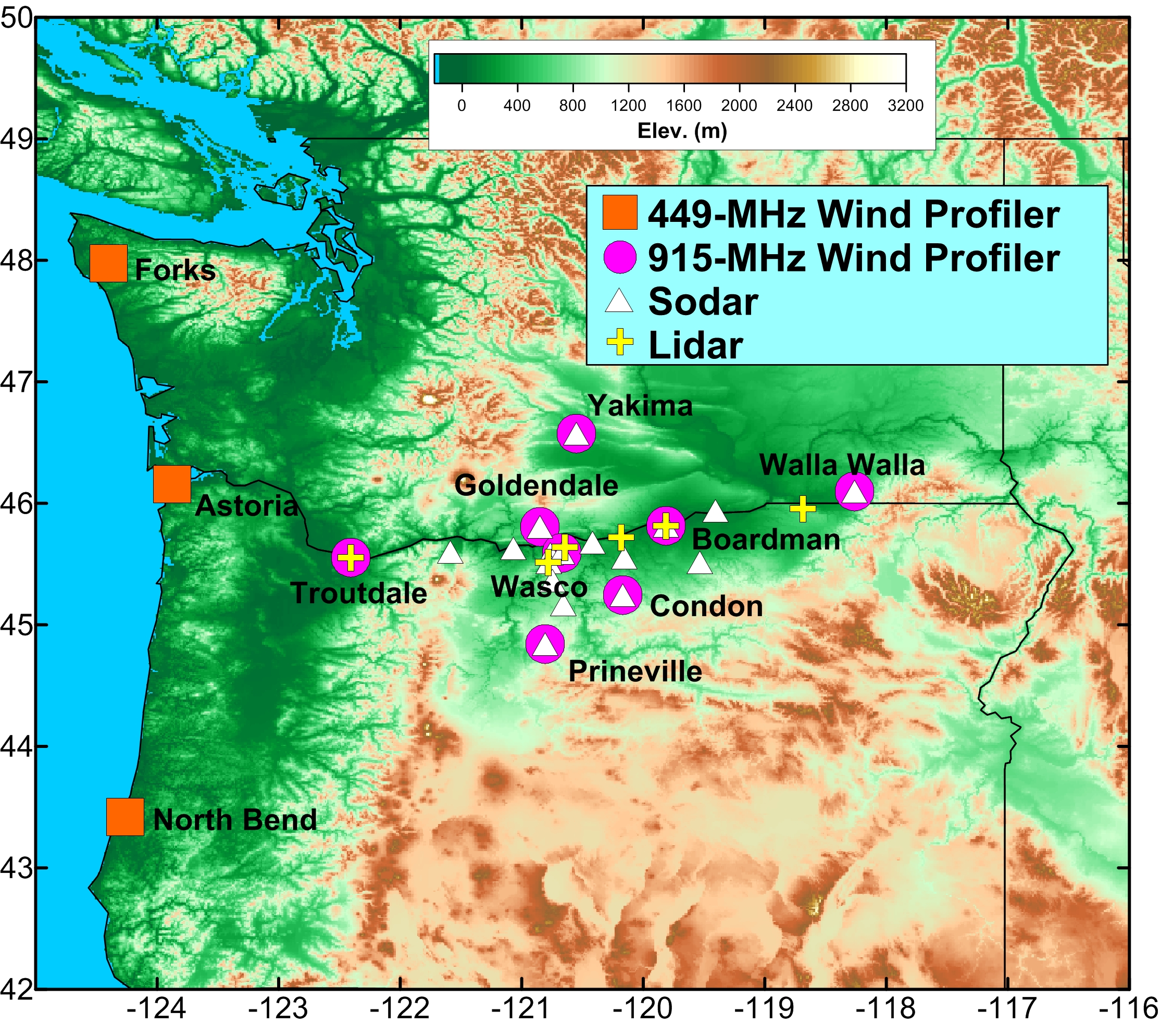
GML GRAD has three sites located in the Columbia River Basin: Condon Airport, OR, Rufus, OR, and Wasco Airport, OR. A mobile SURFRAD unit for measuring the surface radiation budget, meteorology and aerosols is located at the Wasco Airport site, and two portable RadSys systems are located at Condon Airport and Rufus, OR. All three of these systems have the required information for the RadFlux Analysis Programs for additional radiation and cloud information developed by Chuck Long [Long et al., 2000, 2005].
Users can visualize selected instrument observations and model output for dates of interest for other participants here: http://wfip.esrl.noaa.gov/psd/programs/wfip2/. Project data are archived at the PNNL Data Archive and Portal (DAP).
Kathy Lantz, Kathy.o.lantz@noaa.gov, 303-497-7280