Weather Forecasts
Daily Weather Summary
July 8, 1999:
Expect mostly sunny skies today, but more moist air moves back into Tennessee through the day as winds become more SWly by late afternoon at 850 mb, 5-10 kts. High: 90 Low: 71 Mixing Hgt.: 1300 m MSL.
Tomorrow's Forecast
July 9, 1999:
Winds at 850 mb increase out of the SW to 10-15 kts, as frontal boundary moves down into the upper Mississippi River Valley. The air mass remains fairly stable, so expect scattered Cu to form, but only very isolated thunderstorms at best. There may be a few thunderstorms overnight Friday night, as front approaches. High: 92 Low: 72
Day after Tomorrow Forecast
July 10, 1999:
A fairly significant frontal boundary passes through Tennessee on Saturday, bringing good chances for rain and thunderstorms. High: 86 Low: 69
Outlook
Behind frontal boundary, expect drier weather on Sunday, as surface high pressure area takes over. It will also be cooler Sunday and Monday, as highs drop down into the 80s and lows at night go well down into the 60s. Moisture may return some on Tuesday, as flow becomes more southerly again.
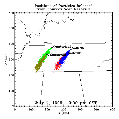
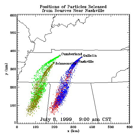
Profiler Plume Depiction
The following shows a depiction of plume locations as predicted by the profiler winds assimilated into a one-dimensional boundary layer model. The top image shows particle positions as of the previous evening. The lower image shows particle positions as of the following morning for particles released beginning the previous noon.
Forecast Plumes
The following gives a depiction of plume locations using a Lagranagian Particle Model coupled to the Regional Spectral Model. The RSM is run daily in a forecast mode at TVA Muscle Shoals, Alabama.
Plume based on 00z initial fields (mpg file optimized for QuickTime)
Plume based on 12z initial fields (mpg file optimized for QuickTime)
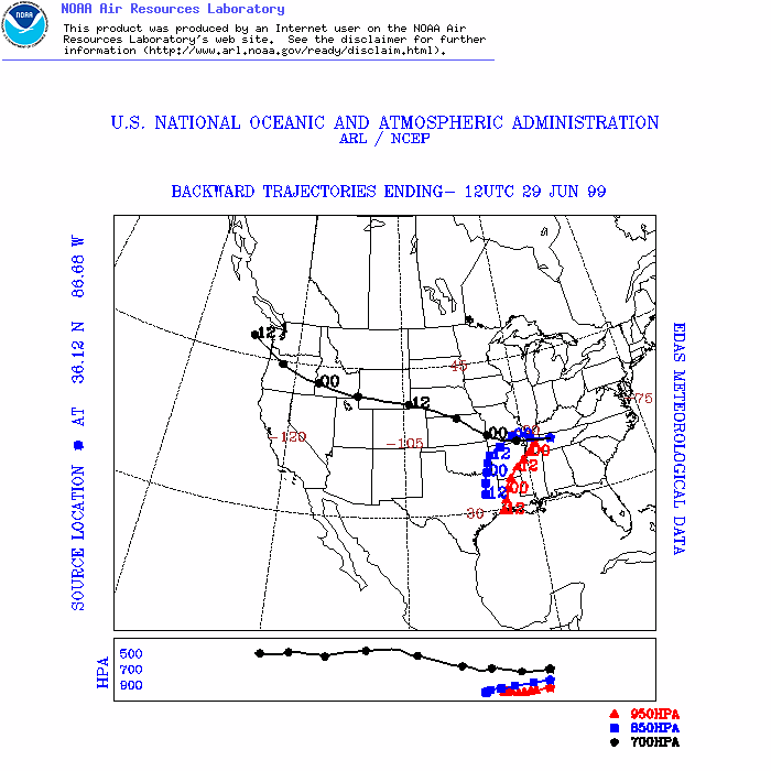
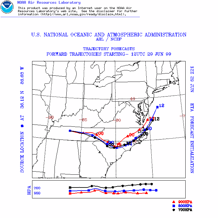
ARL Hysplit Trajectories
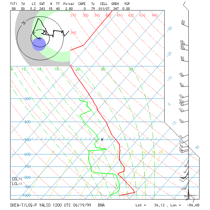
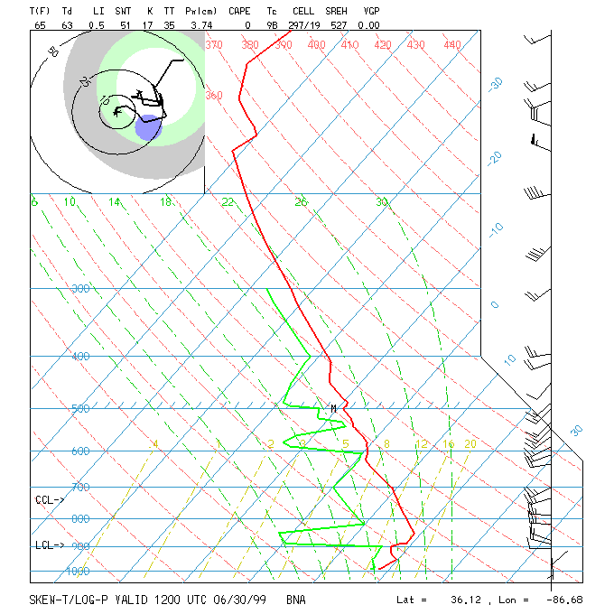
Nashville Soundings