Weather Forecasts
Daily Weather Summary
June 25, 1999:
With the upper level trough to the east, west northwest flow brought clearing to the immediate Nashville area. The slot of dry clear weather is, however, very small. Extensive cloud cover exist to the north of theTN/KY border and clouds and rain exist into northern AL. Mostly fair weather cu at the top of BL thermals are present in the immediate area. Highs today in the middle to upper 80's.
Tomorrow's Forecast
June 26, 1999:
Saturday should bring deteriorating conditions with southwesterly flow and more moisture. Another short wave appraoching the area will give a good chance for thunderstorms(NWS calling for forty per cent chance) with some sun giving away to clouds.
Day after Tomorrow Forecast
June 27, 1999:
Sunday should be mostly cloudy with NWS calling for 60% chance of rain. Winds should be fairly strong from southwest.
Outlook
Models indicate some drying into Monday and Tuesday although short waves propagating under the ridge could still give perios of unsettled weather through Tues. Finally some hope for more quiesent conditions - drier and warmer Wednesday.
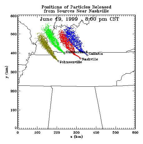
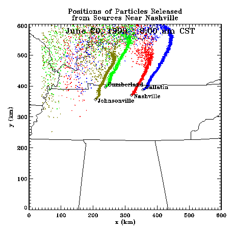
Profiler Plume Depiction
The following shows a depiction of plume locations as predicted by the profiler winds assimilated into a one-dimensional boundary layer model. The top image shows particle positions as of the previous evening. The lower image shows particle positions as of the following morning for particles released beginning the previous noon.
Forecast Plumes
The following gives a depiction of plume locations using a Lagranagian Particle Model coupled to the Regional Spectral Model. The RSM is run daily in a forecast mode at TVA Muscle Shoals, Alabama.
Plume based on 00z initial fields (mpg file optimized for QuickTime)
Plume based on 12z initial fields (mpg file optimized for QuickTime)
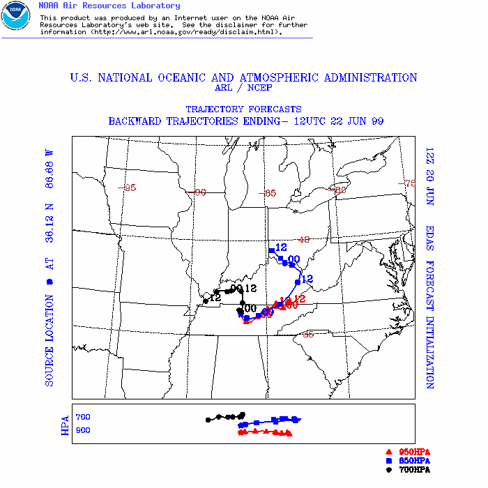
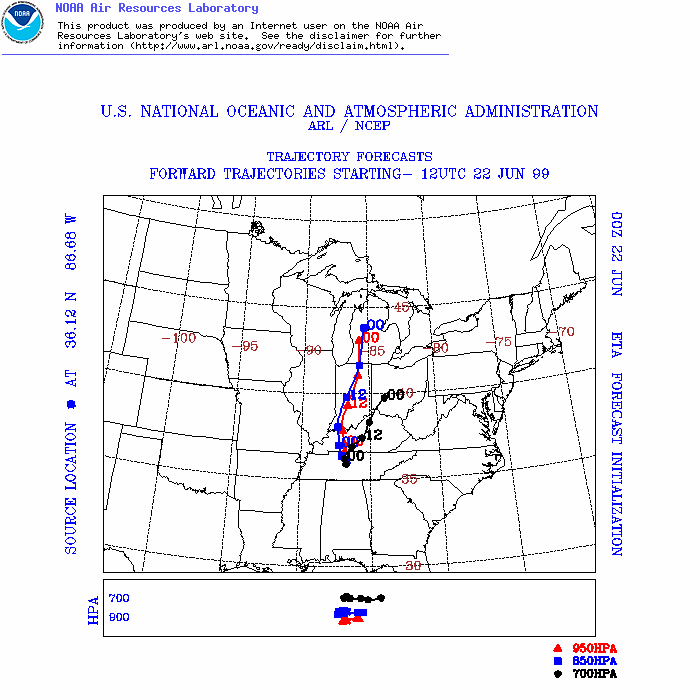
ARL Hysplit Trajectories
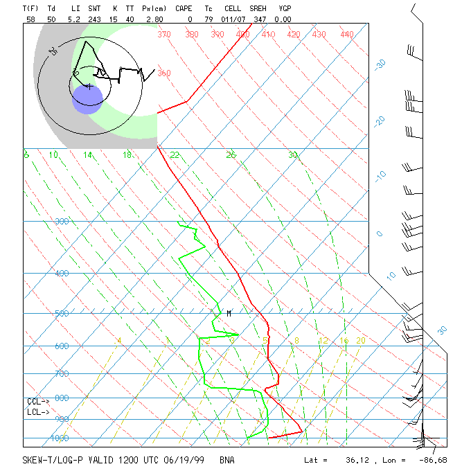
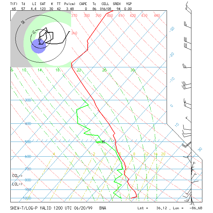
Nashville Soundings