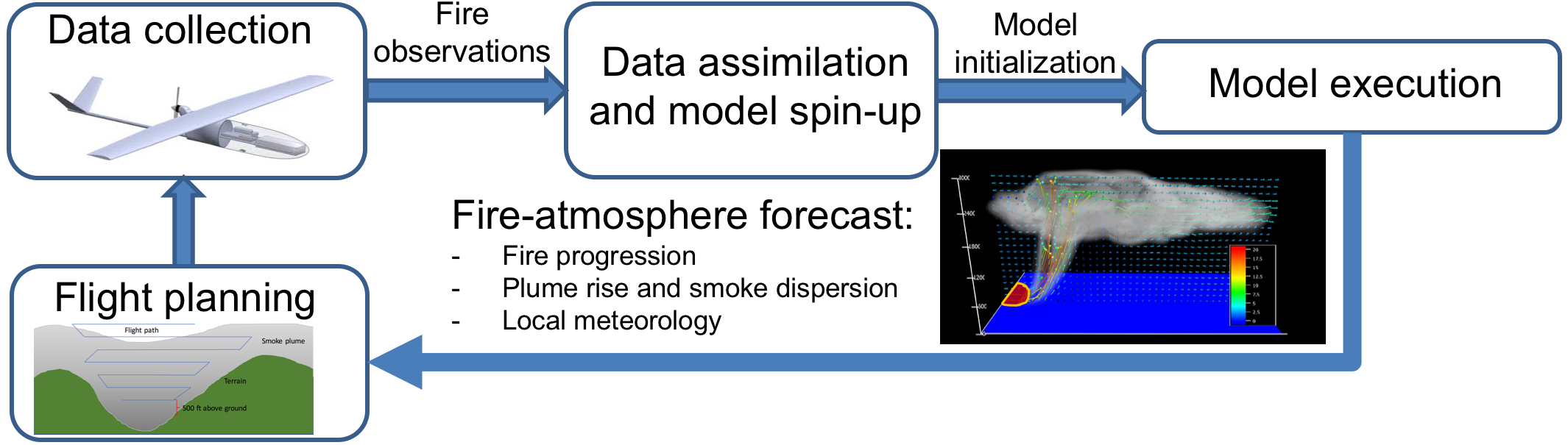
NightFOX Modeling & Forecasting
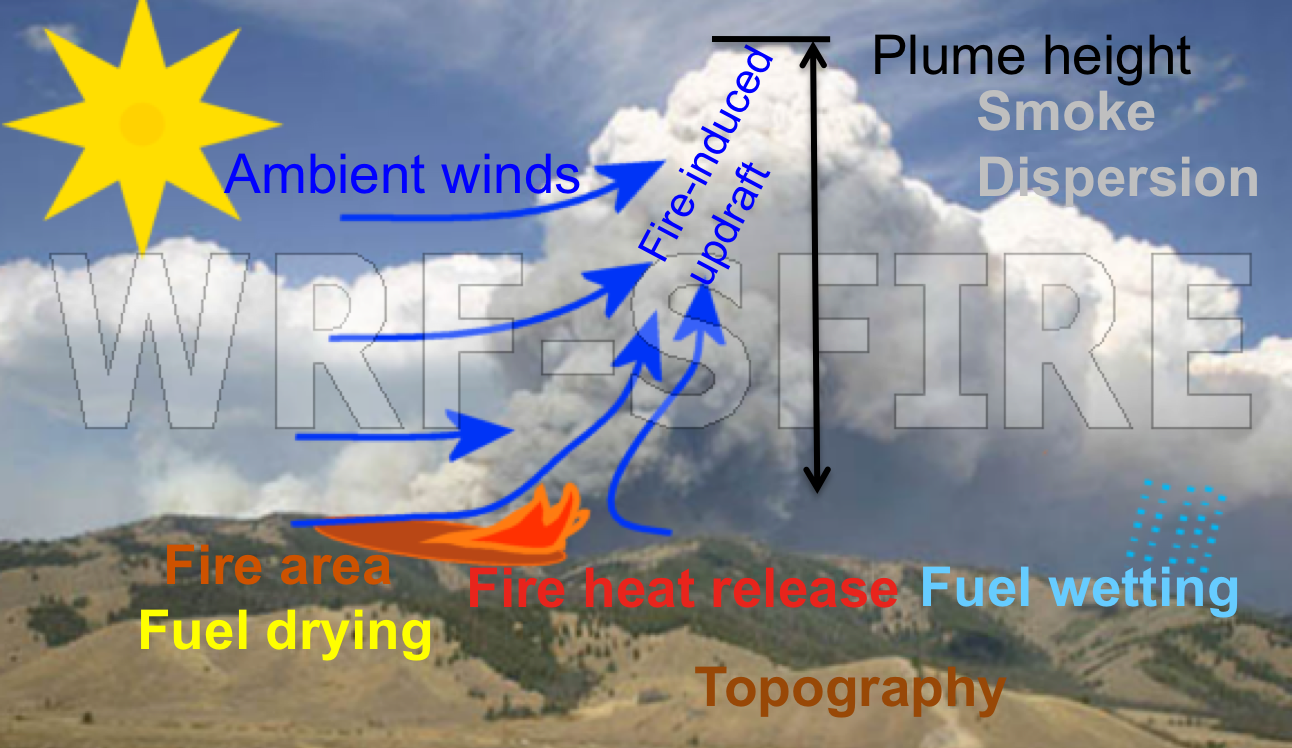
WRF-SFIRE Model
WRF-SFIRE is a multiscale integrated fire-atmosphere model build based on the WRF model, explicitly forecasting fire growth, plume rise and dispersion under dynamically changing weather and fuel moisture conditions.
Fire Data Assimilation
Current operational fire and smoke forecasting systems base on satellite observations available generally once or twice a day with relatively low resolution – ~1km from MODIS and 375/750m from VIIRS. NightFOX examines the possibility of driving coupled fire-atmosphere models with near-real time airborne fire observations, and utilizing model data in flight pattern planning.