R/V Ronald H. Brown Daily Summaries
Cruise Day 20040728
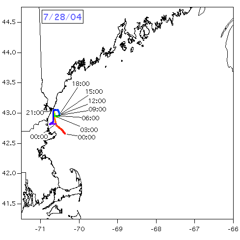
Map:

Met:
RHB moved near the Isles of Shoals during the night and early morning of July 28 to conduct an intercomparison with the team on Appledore Island.
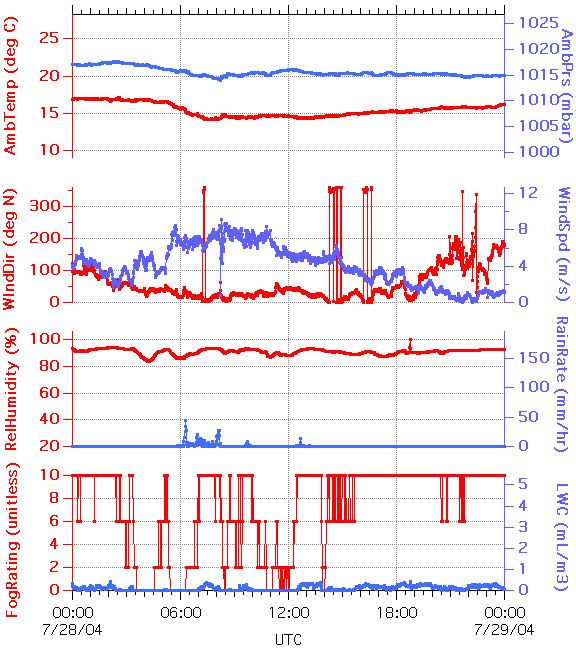
There was significant rain overnight. However just before the rain NO3 and N2O5 levels rose above 100 pptv. Heavy rain washed most of the soluble species including the aerosols from the air-mass. RHB spent most of the day lying east of the isles of Shoals with the scientists performing calibrations and system tests for the most part. The RHB plume was also sampled during the night.
The winds were northerly most of the day, dropping during the day. During late afternoon RHB moved north and west to chase a tanker that was entering Portsmouth harbor. RHB was able to cross the tanker's plume twice. At approximately 5:00 pm local RHB started to move southeast toward Cape Ann. By 7:00 pm RHB had started a series of East/West legs north of the Cape. Winds very light and from the SW.
RHB will continue these tracks all night. We have already passed through several small NOy plumes, at least one of which also had significant NO3/N2O5 in it (after dark, of course).
Early Thursday 29th, RHB will move East of Cape Ann to be in position for the MISER overpass. Plan to be on station by 9:00 AM to coordinate with the J31 and DC-3. Position and overpass dependent upon cloud situation.