R/V Ronald H. Brown Daily Summaries
Daily Summary July 18, 2002, DOY = 199
The ship entered Massachusetts Bay from the south just before midnight and took up station in Nahat Bay, near Marblehead Mass. The ship remained at this location throughout the night. Early the following morning the ship began a series of transects of the Bay just outside of the entrance to Boston Harbor. These transects, with variations to accommodate wind shifts and to facilitate sampling the urban, point source, and ship plumes, continued throughout the day and into the night.
The winds were variable and light through out the period. Early in the day the winds were southwesterly and during the course of the day slowly shifted to the west, the north west and finally to the northeast. The changing wind direction and speed made a challenging problem for the bridge to keep he ship direction and speed adequate to keep sufficient wind over the bow to maintain proper sampling conditions. They accomplished this task masterfully.
The wide variety of high quality measurements being made on the has has provided a more comprehensive picture of nighttime chemistry than has previously been possible. The data collected to date clearly show the complex interplay among the VOC and oxides of nitrogen that control nighttime reactivity. The data from New York Harbor suggest that isoprene and its reaction products can be significant contributors to this chemistry.
The measurements of ozone and aerosols aloft provided by the lidar show the complex vertical structure of the atmosphere, particularly at night. Last night and throughout the day ozone levels above 400 m were elevated, reaching peak values of about 120 ppbv. Ozone levels measured near the surface remained low during the night and then gradually increased to around 90 ppbv over the course of the day.
For all plots, time is indicated in GMT. Eastern time is -5 hours.
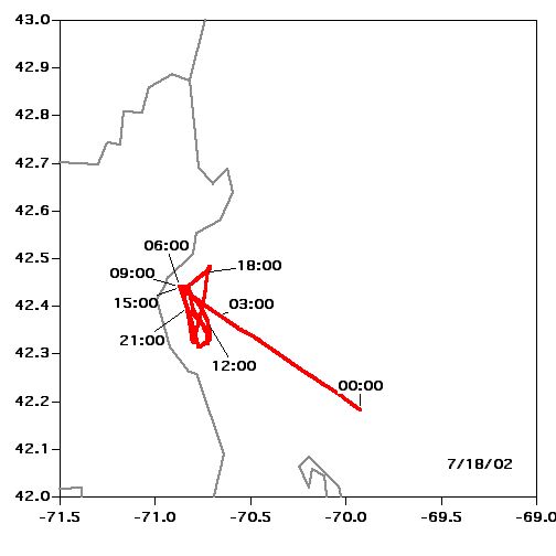 Location |
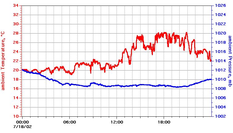 Temperature, Pressure |
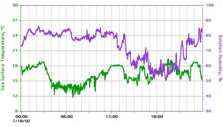 Sea Surface Temperature, Relative Humidity |
 True Wind Speed, Direction |
 hip Speed, Direction |
 Relative Wind Speed, Direction |
Textual information and data plots are for quicklook and overview purposes only.