TexAQS 2006 TOPAZ Lidar data
August 3 - Final Data
| Previous Flight | Archive Calendar | Next Flight |
|---|
Flight #2
Takeoff: 12:43 CDT
Total flight time: 4.5 hours
The objective of this flight was to sample the Houston/Ship Channel pollution plume against a clean southerly flow. The Twin Otter started sampling southwest of Galveston Island and proceeded to the northeast just a few miles offshore to characterize the clean, southerly background flow. At the entrance of Galveston Bay, the Twin Otter overflew the Ron Brown twice and then flew along the Galveston shipping lane and over downtown Houston to the northwest of the Houston metro area to start sampling the pollution plume emanating from Houston and the Ship Channel areas. Due to significant cloud cover just north of Houston the east-west traverses across the pollution plume were moved farther north than originally planned. A total of four legs across the pollution plume were completed, extending to several miles north of Conroe. The core of the plume was found to extend northward along I45. The data collected on this flight will be potentially useful for calculating the horizontal ozone flux exported by the Houston area.
Select an image to view full resolution
Ozone Cross-section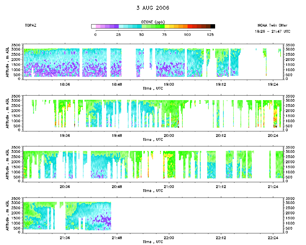 download ICARTT format data (ict file) download simple ASCII data (txt file) |
Aerosol Cross-section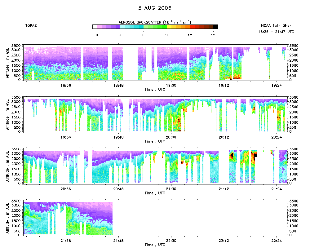 download ICARTT format data (ict file) download simple ASCII data (txt file) |
Ozone Map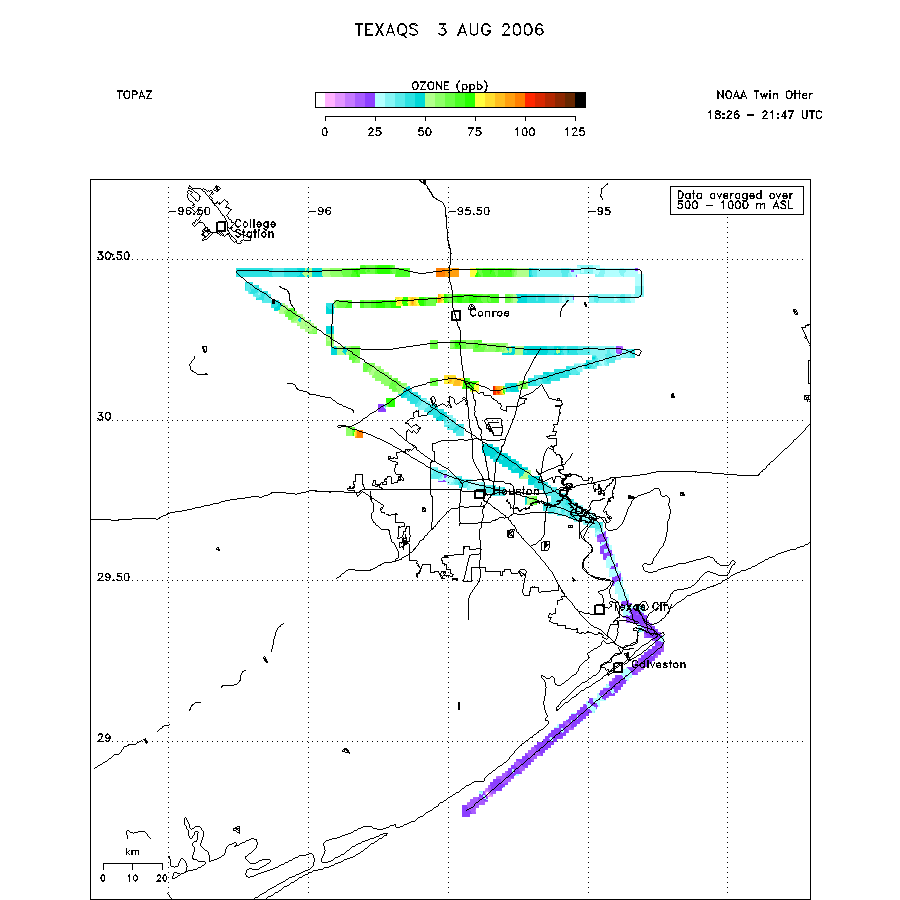 |
Mixed Layer Height Map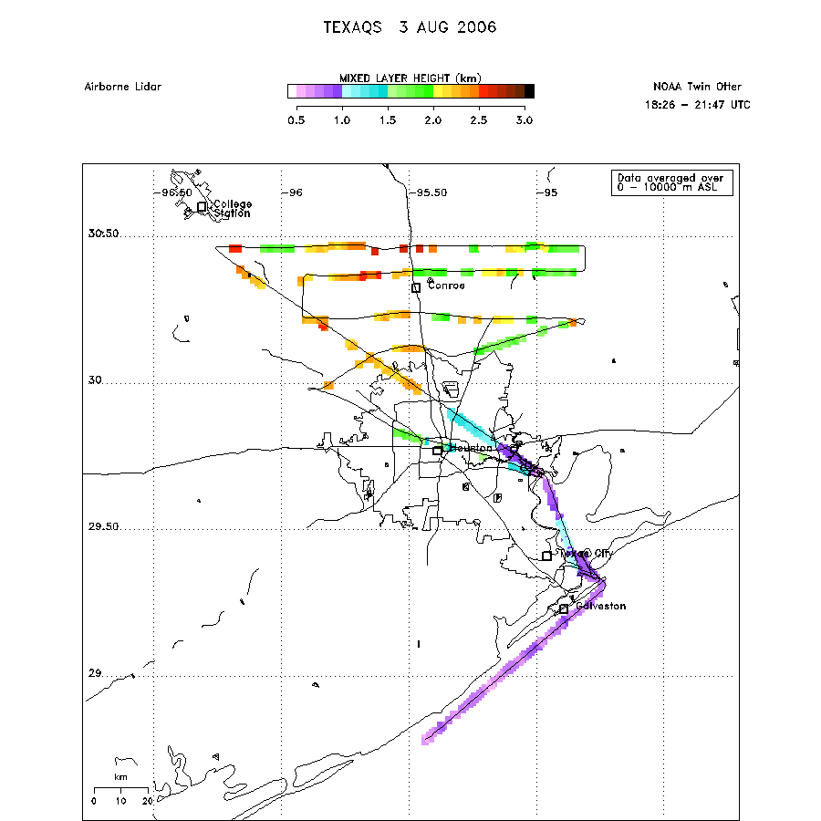 download ICARTT format data (ict file) download simple ASCII data (txt file) |