WP-3D Daily Summaries
7/21/04 WP-3D Flight Summary (Preliminary Observations)
This flight was planned as the second leg of a three-day quasi Lagrangian study. The New York City plume that had been intercepted on July 20th was predicted to be over the Gulf of Maine. Two balloons that were launched on Monday, the Airmap balloon from Orient Pt., Long Island and the UMASS balloon from Woods Hole, helped track the flow of the NYC plume overnight.
On the flight on Wednesday (7/21), the New York City plume (now 1.5 to 2.5 days old) was intercepted in the lower troposphere on extended sections of the flight. The outbound northeasterly leg sampled the plume downwind following a zigzag patterned flight track that measured air that was becoming progressively more aged. The aircraft flew within this plume flow throughout most of the outbound flight. At roughly 42N and 66.38W CO mixing ratios of 220-250 ppbv and ozone levels of 100-120 ppbv were observed. Further downwind at about 43.88N 65.9W, CO and O3 mixing ratios were steady at 240 and 120 ppbv respectively. Here the plume extended from 1000 to 3500 ft altitude. Southeast of Halifax, the plume had mixing ratios of 210 ppbv CO, 100 ppbv O3, and a few ppbv of SO2.
The return of the flight went southwestward along the estimated position of the spine of the plume. At about 67W plume was mixed up to 5500 ft. Shortly thereafter and relatively closer to NYC, high ozone (185 ppbv) and high CO (360 ppbv) were encountered at about 1000 ft altitude. On the last section of the flight back to Portsmouth, a biomass-burning plume was encountered above Cape Cod at about 11000 ft. The location of this feature had been identified earlier on visible satellite photos. In this plume, CO mixing ratios above 300 ppbv were encountered and acetonitrile, the biomass-burning plume-tracer, was strongly enhanced.
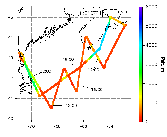
Actual Flight Track
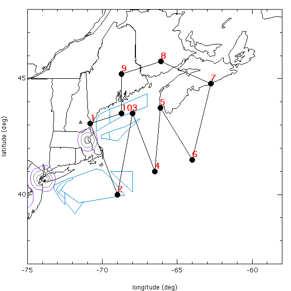
Flight Plan Map
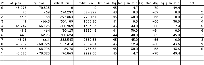
Flight Plan Way Points