R/V Ronald H. Brown Daily Summaries
Daily Summary July 30, 2002, DOY = 211
The ship spent the night making NW/SE tracts across Massachusetts Bay. Winds were light shifting from SE to SW. The DOE G-1 overflew the ship at approximately 0330 UTC. The airmass during the night was moderately polluted with elevated levels of NOx, SO2, anthropogenic oxygenated hydrocarbons. A distinct layer of O3 and aerosols was observed aloft. In the morning the SE tract was extended to Cape Cod (1200-1600UTC) with a return leg towards Nahant Bay. A region of high light scattering by aerosols was encountered from 1300-1600 UTC (east of 70deg25min). Ozone peaked at 100ppb at 1600UTC. The wind shifted from SW to NW at 1700, to W at 1900, and back to NW at 2200. The ship's course was adjusted to keep the transit legs perpendicular to wind. NO3 and N2O5 were present during the day at 0.5 ppt.
For all plots, time is indicated in GMT. Eastern time is -5 hours.
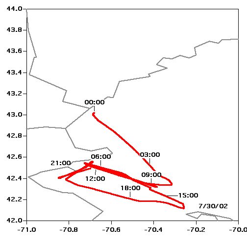 Location |
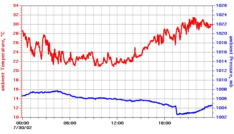 Temperature, Pressure |
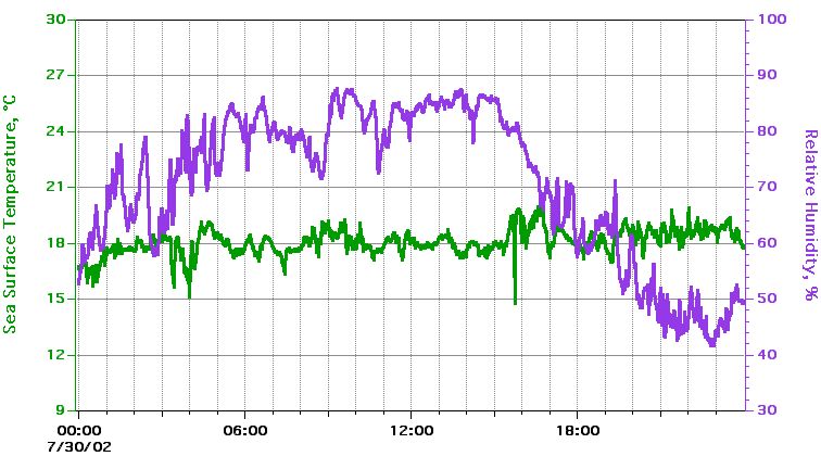 Sea Surface Temperature, Relative Humidity |
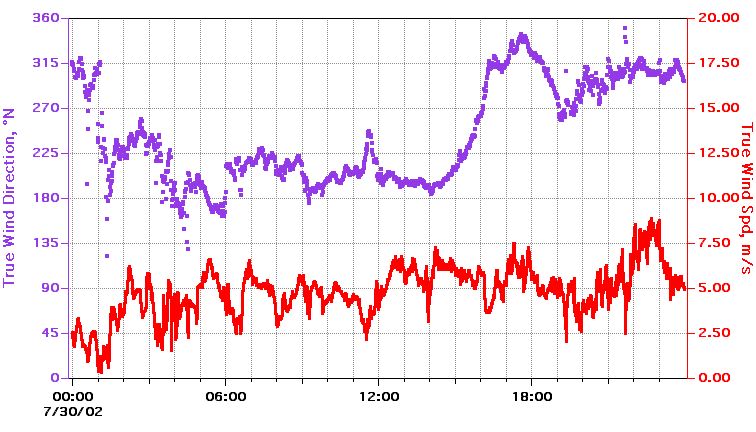 True Wind Speed, Direction |
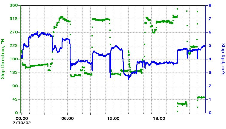 Ship Speed, Direction |
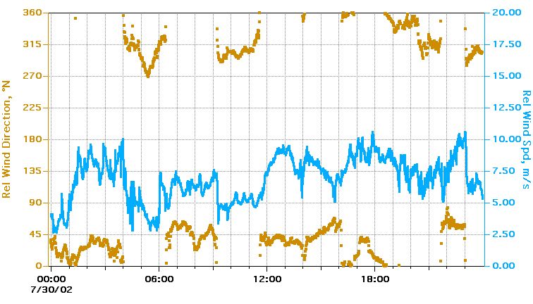 Relative Wind Speed, Direction |
Textual information and data plots are for quicklook and overview purposes only.