TexAQS 2006 TOPAZ Lidar data
August 1 - Final Data
| Previous Flight | Archive Calendar | Next Flight |
|---|
Flight #1
Takeoff: 9:15 CDT (Boulder, CO)
Total flight time: 7.9 hours
The NOAA Twin Otter ferried to Houston from Boulder, CO. After a refuel stop in Wichita Falls, TX, the Twin Otter took off around 15:00 CDT for the second leg of the ferry flight to Houston. Data were collected on the south side of Dallas, during the transit to Houston, and on the north and east side of the Houston metro area. Observed ozone concentrations were generally in the 30 to 50 ppb range, with higher values measured north of Houston, presumably associated with the Houston/Ship Channel plume.
Select an image to view full resolution
Ozone Cross-section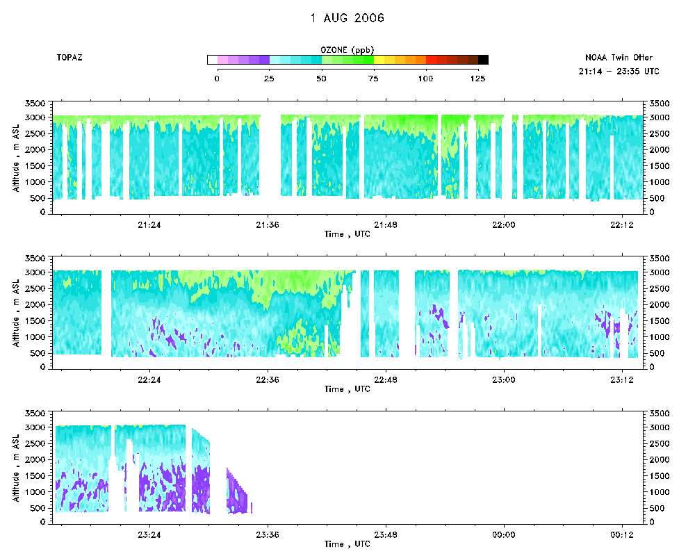 download ICARTT format data (ict file) download simple ASCII data (txt file) |
Aerosol Cross-section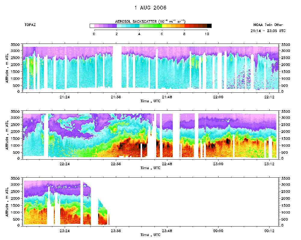 download ICARTT format data (ict file) download simple ASCII data (txt file) |
Ozone Map |
Mixed Layer Height Map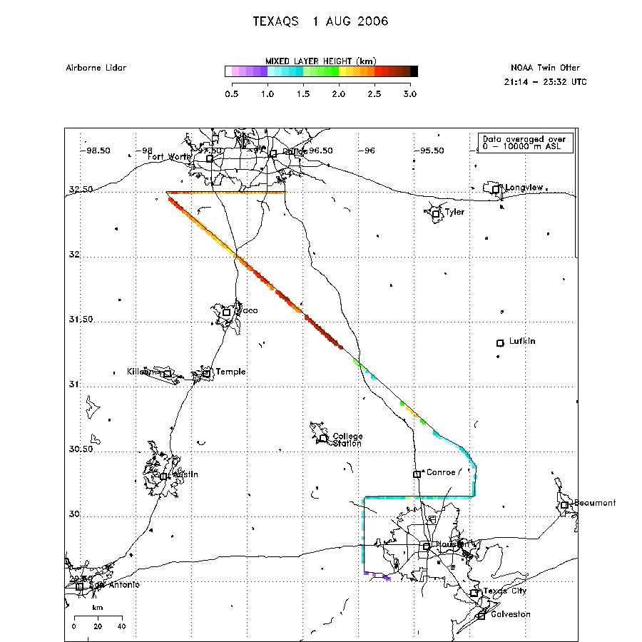 download ICARTT format data (ict file) download simple ASCII data (txt file) |