CalNex TOPAZ Lidar data
June 30 - Flight B - Preliminary Data
| Previous Flight | Archive Calendar | Next Flight |
|---|
Flight #33: Return flight from San Diego to Ontario
Flight level: 6500-10500 MSL
Takeoff : 14:40 PST
Duration : 1:59 h
Objective : Takeoff at North Island Naval Air Station, land at ONT. Map the horizontal and vertical distribution of pollutants over and east of San Diego, along Mexico border, and enroute to Ont through Imperial Valley and LA basin.
Select an image to view full resolution
Ozone in Google Earth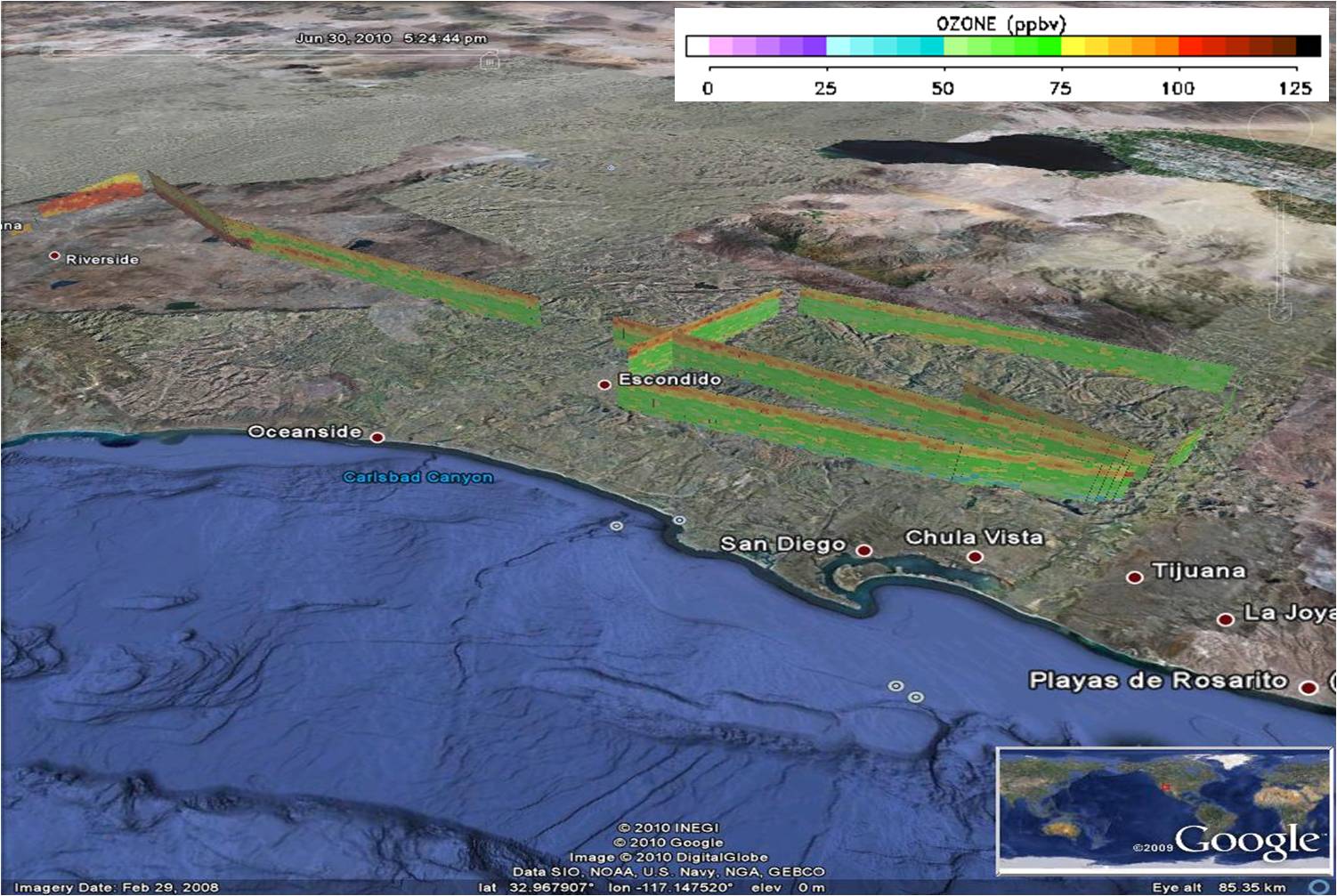 Get the Google Earth kml file |
Ozone Cross-section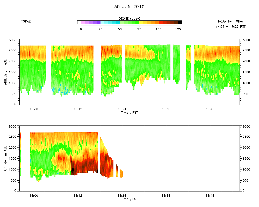 Download the ASCII file |
|---|