CalNex TOPAZ Lidar data
June 30 - Flight A - Preliminary Data
| Previous Flight | Archive Calendar | Next Flight |
|---|
Flight #32: Sampling flight to Mexico via Salton Sea
Flight level: 1000-6500 MSL
Takeoff : 8:12 PST
Duration : 3:18 h
Objective : Takeoff from ONT, land at North Island Naval Air Station. Early flight primarily DOAS flight, mapping distribution of pollutants at 1000 ft MSL over and near the Salton Sea. Later flights along Mexican border and into Mexico to map the horizontal and vertical distriburtion of urbam and power-plant pollutants, and horizontal fluxes along the border.
Select an image to view full resolution
Ozone in Google Earth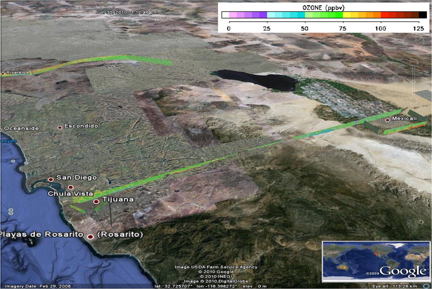 Get the Google Earth kml file |
Ozone Cross-section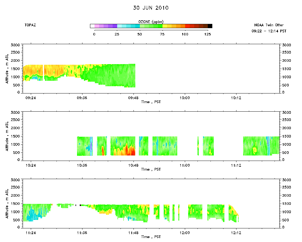 Download the ASCII file |
|---|