CalNex TOPAZ Lidar data
July 2 - Preliminary Data
| Previous Flight | Archive Calendar | Next Flight |
|---|
Flight #34: Survey pollution in the northern LA basin
Flight level: 11500-13500 MSL
Takeoff : 14:03 PST
Duration : 3:44 h
Objective : Characterize 3-D distribution of O3 and other pollutants in the LA basin and mountain/mountain passes to the north and west.
Select an image to view full resolution
Ozone in Google Earth Get the Google Earth kml file |
Ozone Cross-section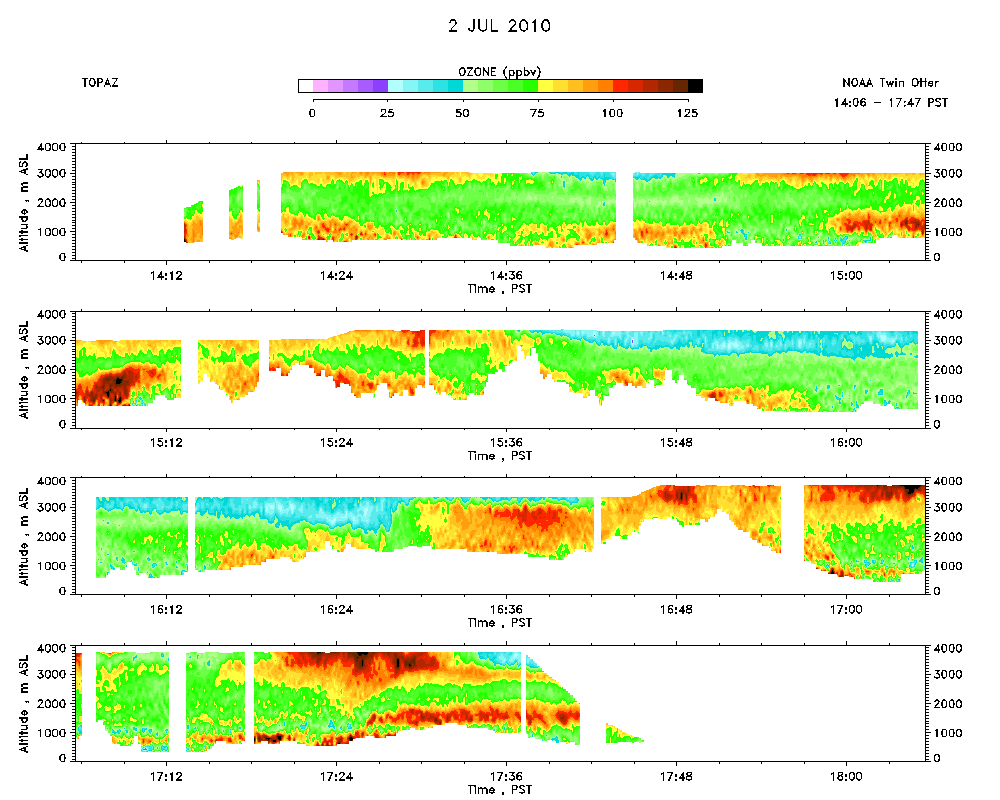 Download the ASCII file |
|---|