CalNex TOPAZ Lidar data
July 15 - Preliminary Data
| Previous Flight | Archive Calendar | Next Flight |
|---|
Flight #42: Survey pollution in the LA Basin
Flight level: 1500 AGL - 10500 MSL
Takeoff : 14:30 PST
Duration : 3:00 h
Objective : Map pollution in the LA Basin, and characterize export of pollutants through Cajon Pass and over mountain ridges.
Select an image to view full resolution
Ozone in Google Earth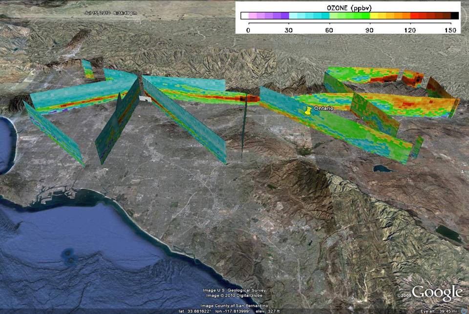 Get the Google Earth kml file |
Ozone Cross-section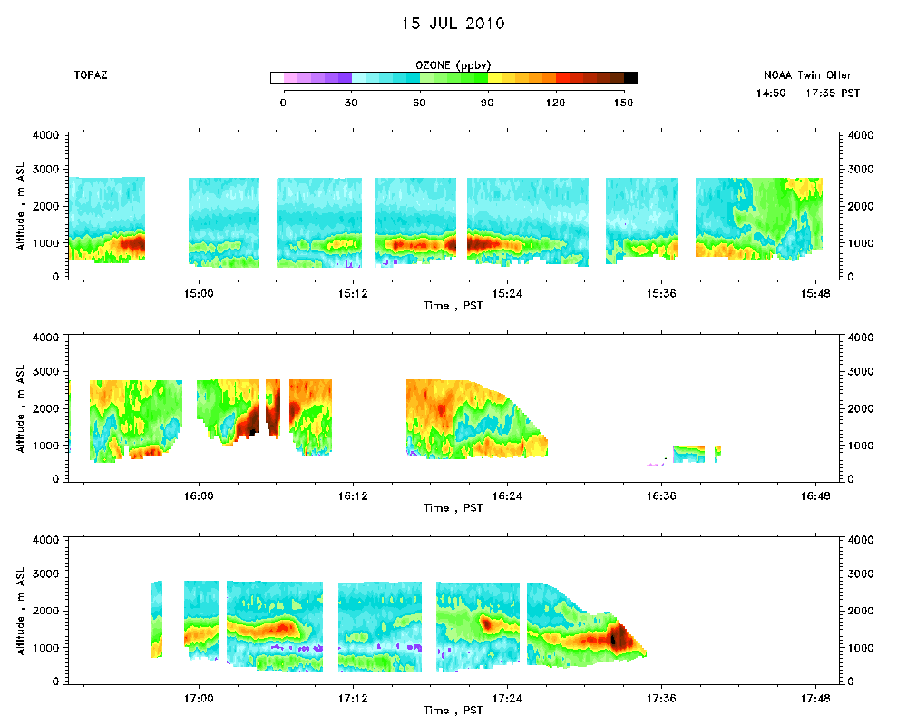 Download the ASCII file |
|---|