CalNex TOPAZ Lidar data
July 12 - Preliminary Data
| Previous Flight | Archive Calendar | Next Flight |
|---|
Flight #39: Survey pollution in the LA basin and transport over mountains and through passes to N and W
Flight level: 6500-13500 MSL
Takeoff : 14:45 PST
Duration : 3:30 h
Objective : Characterize 3-D distribution of O3 and other pollutants in the LA basin and San Bernardino Mountains. Look for transport through Cajon and Banning Passes.
Select an image to view full resolution
Ozone in Google Earth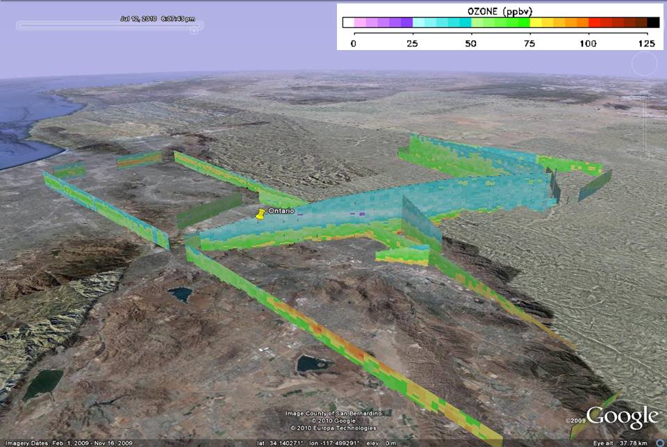 Get the Google Earth kml file |
Ozone Cross-section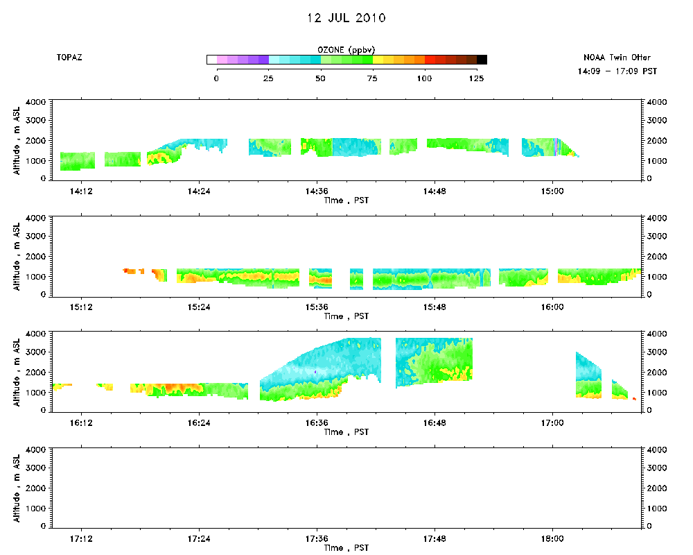 Download the ASCII file |
|---|