Stratus '03
As part of the NOAA CLIVAR/Ocean Climate Observations program, ETL conducted measurements of air-sea fluxes and cloud properties during the November, 2003 cruise to recover the WHOI Ocean Reference buoy at 20 S, 85 W (approximately 1000 km west of the Peru/Chile border). The R/V Roger Revelle departed from Manta, Ecuador on Nov. 11th, travelled south along 85W until arriving at the buoy on Nov. 15th (12 UTC), remained stationary for 6 days, then left on Nov. 21 (12 UTC) and travelled due east until arriving at Arica, Chile.
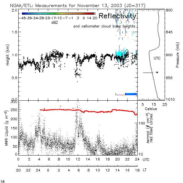
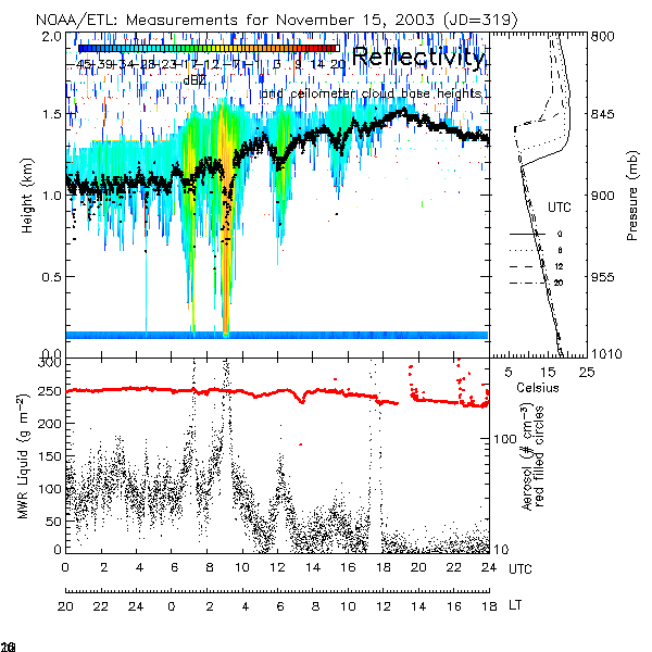
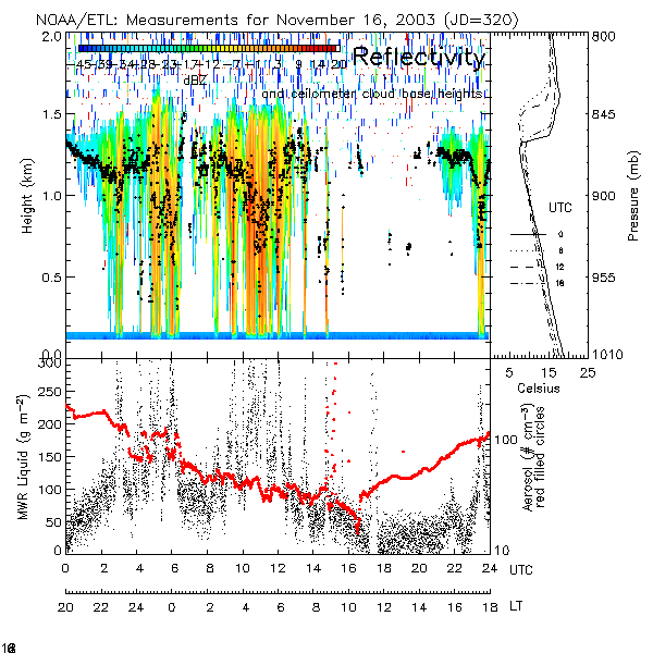
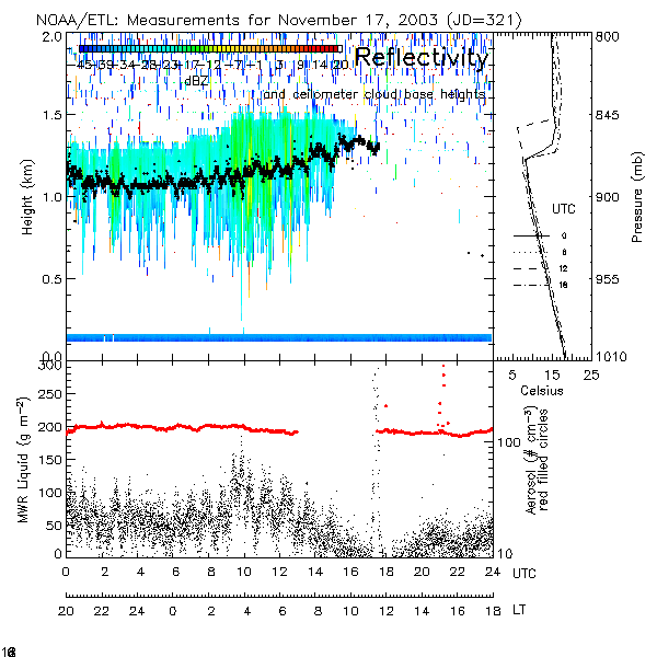
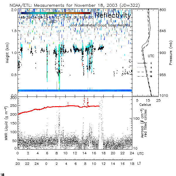
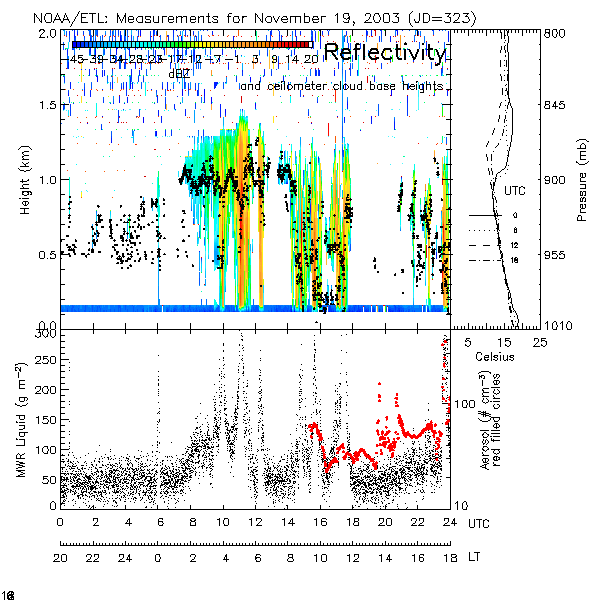
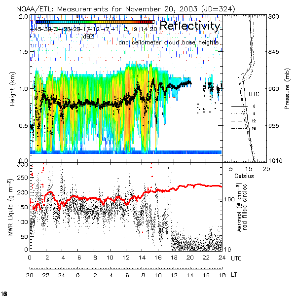
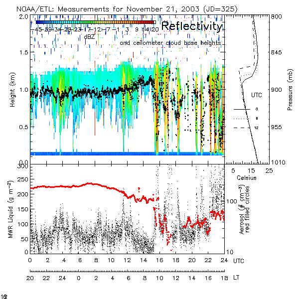
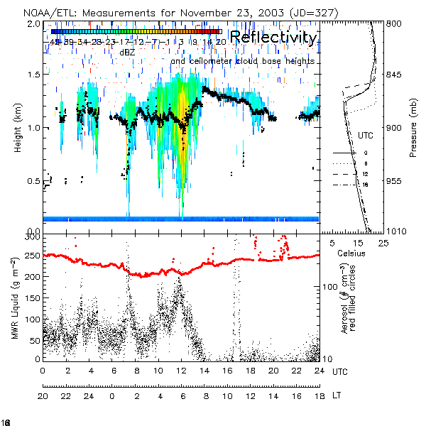
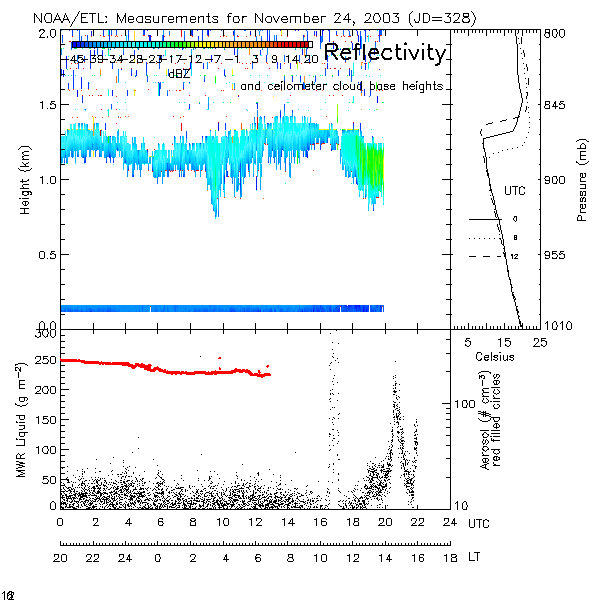
The goal of the observations was to better document the structure of the SE Pacific stratocumulus and its interaction with the underlying ocean, thereby improving our physical understanding of and ability to model this climatically-important region. Towards this end, data were continuously gathered from a vertically-pointing cloud radar, microwave radiometer (for liquid water path and water vapor path estimates), ceilometer (primarily for cloud base height estimates), as well as flux sensors. An important addition were surface measurements of aerosol number concentrations, facilitating investigations of aerosol effects upon cloud properties and the stratocumulus hydrological cycle.
Data available at ftp://ftp1.esrl.noaa.gov/users/pzuidema/pacs03/.
| Radar | Flux | Soundings | GOES VIS | GOES IR | |||||||||||||||||||||||||||||||||||||||||
| |||||||||||||||||||||||||||||||||||||||||||||