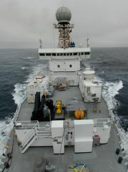
A view of
the RB from the jackstaff. The lidar and radar are located in seatainers
on the middle deck.
|
The 2001 EPIC Field Program
EPIC is a joint NOAA/NSF project to study air-ocean coupling in
the inter-tropical convergence zone and stratus clouds associated
with the equatorial cold tongue in the Eastern Pacific near the
Galapagos Islands.
A fundamental aspect of this program will be an in-situ
and remote study of stratocumulus clouds in the region from the
NOAA R/V Ron Brown. Subtropical stratocumulus clouds have a
strong cooling effect both on the ocean and atmosphere. Furthermore,
seasonal and interannual variations in SE Pacific stratocumulus cloud
cover are poorly represented in current Global Climate Models and are
a key component for coupled modeling of ENSO. It is a central goal of
EPIC to document, understand, and better model the structure of the
SE Pacific stratocumulus and its effects on the underlying ocean.
ETL is providing a suite of sensors including cloud radar, lidar,
radiometers and flux sensors to study clouds, precipitation and
air-sea interactions in addition to supporting flight operations
with forecasting and special satellite products.
For more information about ETL work at EPIC see the following
working groups.
Air-Sea Interaction
Continuing a three year study of clouds, surface fluxes, and boundary
layer properties in the Eastern Pacific as part of the EPIC monitoring
program, the Air-Sea Interaction group leads ETL efforts in this
area.
A Climatology
of Stratocumulus Cloud Properties in the PACS Region, C.W. Fairall,
et. al. is the latest report on these studies.
Measurements of sensible, latent heat and momentum fluxes,
broadband radiative fluxes, and surface meteorology for will be taken
for the duration of the program to document all terms of the
surface heat budget.
Lidar Research
Lidar studies provide details on the oceanic winds, clouds, and
humidity structure of the atmosphere which contribute to our understand
of energy exchanges between the air and sea, the effect of clouds on
the heating and cooling at the ocean surface and the movement of air
masses between the hotter/humid and cooler/drier regions off South America.
Radar Research
The Cloud Radar group operates a Doppler Ka-band cloud
radar (MMCR) and a microwave radiometer (MWR) suite developed at ETL
which from which many cloud and precipitation characteristics can
be derived, including microphysical quantities of ice clouds and
drizzle, cloud droplet size, number concentration, liquid water
concentration, and in-cloud vertical velocity statistics. These
parameters are critical to understanding the ways in which clouds
impact energy flux.
Satellite Research
The ETL Satellite Research Group is involved in the EPIC 2001 field
experiment by providing numerous
satellite-derived products
that will be
used in real-time to support flight operations and later in the data
analysis and research steps. Dr. John Bates is leading this effort and
will be lead forecaster for aircraft operations on location in Huatulco
, Mexico. He will use satellite products developed at ETL and a direct
read-out satellite ground station provided by UCAR JOSS to help plan and
execute flight operations for the NOAA P3 aircraft and the NSF C-130
aircraft.
|