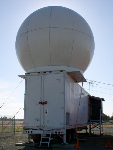
SkyWater radar in Lincoln, CA (Photo by Clark King)
Scanning Precipitation Radars
SkyWater
SkyWater radar is a C-band (5-cm wavelength) scanning Doppler radar deployed in 2011 to support atmospheric river (AR) research in California. ARs are narrow regions in the atmosphere, which transport water vapor outside of the tropics and contribute significantly to water supply and flood generation in the state. SkyWater was originally was deployed in the area during the late 1970s and early 1980s as part of the Sierra Cooperative Pilot Project (SCPP), but only produced reflectivity information. Over the past few years, PSL staff have upgraded the radar to provide Doppler capability, which is being applied in a multi-Doppler analysis mode to derive 3-D winds in precipitation.
Data collected from the radar will be used in combination with National Weather Service Doppler radar data to document the three-dimensional structure and evolution of the strong, concentrated winds blowing along the Sierra Nevada mountain range, called Sierra barrier jets (SBJs). SBJs are a dominant feature of Sierra Nevada storms and impact the way precipitation is distributed. This radar has a typical range of 125 km, and is well-suited to monitoring precipitation.
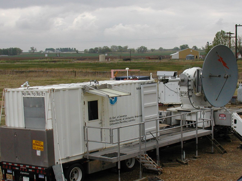
HYDRO-X radar (Photo by Kurt Clark)
HYDRO-X
PSL developed and continuously enhances this 9.3 GHz scanning X-band radar primarily for observations of the ocean surface, rain, snow, storm airflow patterns and for hydrological research and support applications. The radar features Doppler, dual-polarization and full scanning capability, including the ability to scan downward beneath the horizon for ocean work. Polarization options include switching between H and V, circular, or "split" H/V. Polarization measurements include differential phase (Kdp), and differential reflectivity (ZDR) which can be used for more accurate estimates of rainfall rate and identification of precipitation particle types. The radar is transportable in North America on its own trailer or it can be packaged into standard shipping containers for shipping overseas.
The radar uses the Radar Control, Acquisition and Display System (RCADS) data system developed by PSL. RCADS supports many types of scanning protocols including Sector scanning, RHI scanning, PPI scanning and fixed beam data acquisition and in some applications can be synchronized to other radars. The Display sub-system allows the operator to choose between 32 derived fields to view in real-time. The Acquisition sub-system includes a fully digital receiver including phase correction and frequency tracking for use with magnetron (incoherent) transmitters. The Control sub-system gives the operator full control of all radar hardware functions, including system health monitoring. All three sub-systems can be accessed remotely over the internet for full unattended operation. Radar data is also shipped over the internet in real-time to PSL in Boulder for further processing and analysis.
Efforts are currently under way to increase transmitted power and improve polarization purity, as well as adding additional polarization configurations.