 |
||||||||
|
||||||||
Joint Project to Measure Soil Properties Across California
May 20, 2011
When California experiences its first storms of the wet season, the vast unirrigated regions of the state are replenished with life sustaining water. The uptake of water by the soil also can determine whether a storm produces flooding. If the soils are dry enough, these early season storms do not induce widespread flooding. However, when the soils are wetter, like later in the winter, more of the liquid precipitation runs along the land surfaces, increasing runoff and the potential for floods. Some soils may essentially soak up the first few inches or more of precipitation before heavy runoff can begin.
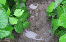
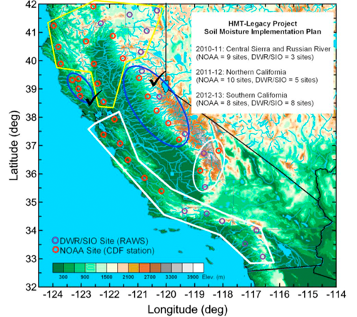
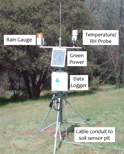
Under a five-year agreement between the Physical Sciences Laboratory (PSL) and the California Department of Water Resources (DWR), 43 soil science stations are being deployed across the state using modern, unattended soil measurement techniques that only have been available over the last decade or so. So far a dozen of these stations have been installed in the flood-prone Russian River Valley north of San Francisco and along the foothills and upper elevations of the central Sierra. Because research conducted under NOAA's Hydrometeorology Testbed (HMT) has shown that soil properties vary with elevation in the Sierra, DWR and the Scripps Institution of Oceanography (SIO) will partner to put soil stations at higher elevations across the state, while PSL will concentrate on lower elevation installations. DWR and SIO are taking advantage of existing monitoring and communications infrastructure at interagency Remote Automated Weather Stations (RAWS). PSL is partnering with the California Department of Forestry and Fire Protection (CalFire) to locate sensors near CalFire Stations. In addition to measuring soil temperature and volumetric moisture content at two levels (10 and 15 cm below the surface), these sites also measure air temperature, relative humidity, and rainfall. The observed data are transmitted back to DWR and PSL through satellite communications, telephone lines, or wireless internet. Numerical data and time series images are available to everyone on PSL's website, and rainfall data are transmitted to the National Weather Service (NWS) Western Region Headquarters in the preferred NWS format. Soon, soil temperature, soil moisture, and surface meteorology parameters will be added to this special NWS data feed.
The soil science stations are part of an unprecedented observing network being developed for California that will provide critical information on the forcings of extreme precipitation and flooding, as well as long-term climate observations to help decision makers adapt to a changing climate.