CalWater Early Start: Deployment of Aerosol – Meteorological Observatory
23 February 2009
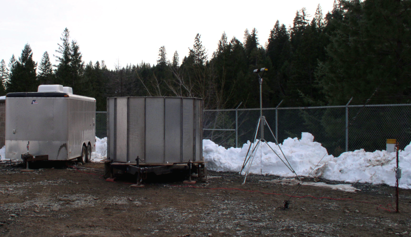 Equipment at Sugar Pine site. Left to right: equipment trailer housing the radar electronics, the S-band antenna, the Parsivel Distrometer, and a heated tipping bucket rain gauge. Not shown: 10-m meteorological tower. (Photo by Clark King, NOAA) |
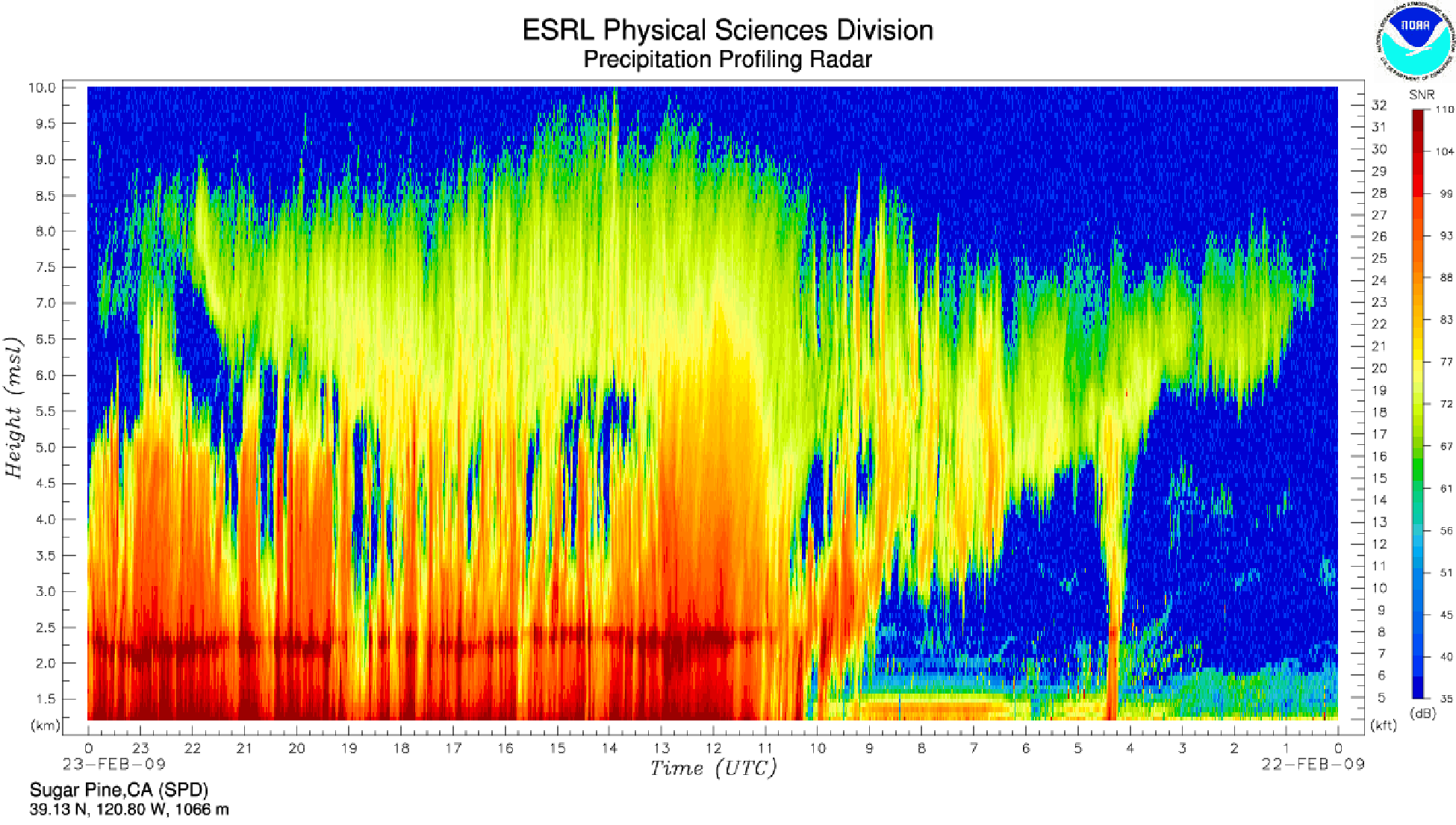 Figure 1.State-of-the-art vertical profiling precipitation radar observations of a major storm that struck 2 days after the deployment of this "S-Prof" radar for the CalWater Early Start Experiment in the foothills of the Sierra Nevada Mountains of California. The data clearly show a descending upper cloud (note time increases from right to left in this display) that reaches the surface. The snow-level is indicated by the radar bright band at ~2.2 km MSL), as is the episodic decoupling between the upper cloud and the lower-altitude precipitation (note blue areas between 3.5-5.5 km MSL). |
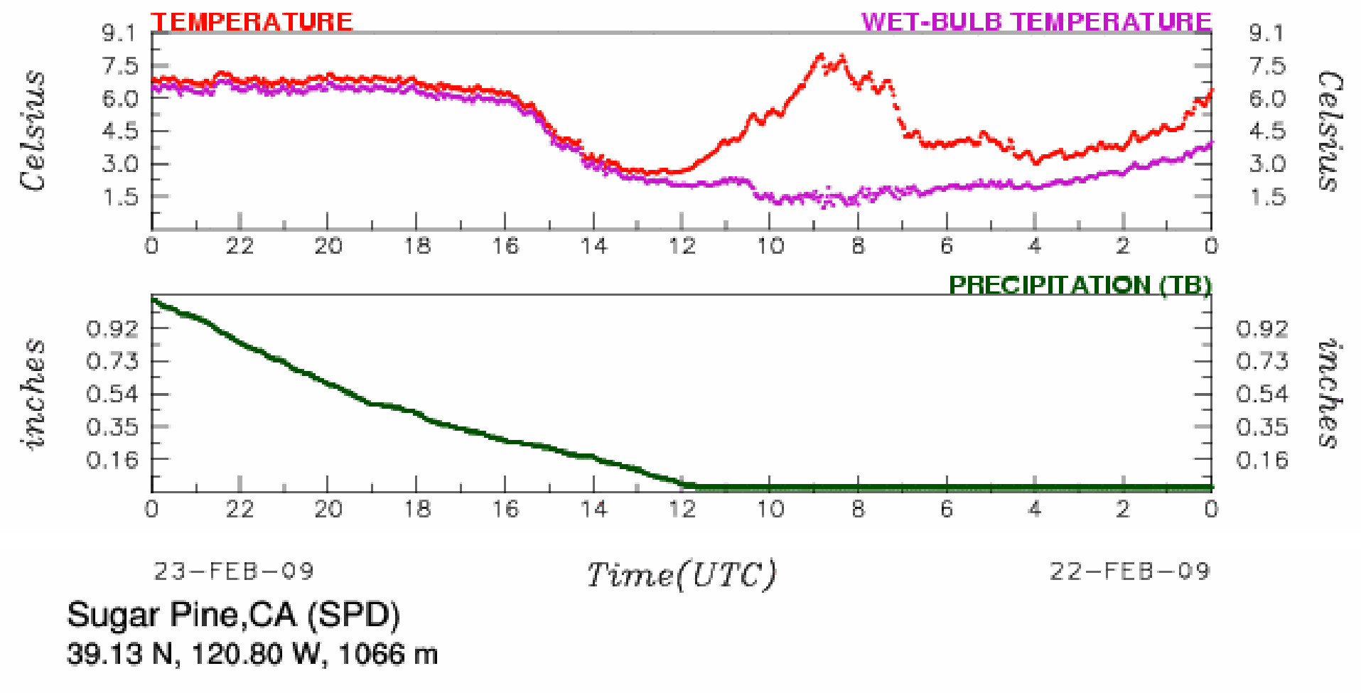 Figure 2.Surface meteorological observations of temperature and precipitation at same site as the S-Prof radar data shown in Fig. 1. Note that the site received over 1 inch of rain on this date. |
NOAA Earth System Research Laboratories scientists and colleagues from the
Universities of California at San Diego and at Davis have installed an
Aerosol – Meteorological (Aerosol – Met) observatory in the central
California Sierra Nevada to observe the aerosol content within individual
raindrops and snowflakes. This first-ever observatory combines NOAA's
expertise in observing and diagnosing the vertical structure of
precipitation and its mesoscale meteorological forcing with the University
of California's expertise in observing and identifying the content and size
of aerosols inside the precipitation, including fingerprinting the aerosols
and their origins. The Aerosol – Met observatory was installed about
half-way up the slope of the Sierra Nevada in the American River basin
(ARB) at the Sugar Pine Reservoir. Observations collected for NOAA's
Hydrometeorological Testbed (HMT; see
The Aerosol – Met observatory has been deployed as an "early start" component of the "CalWater" experiment scheduled for the November 2009 - March 2010 winter season. CalWater is sponsored by NOAA and the California Energy Commission and includes the deployment of up to 4 Aerosol – Met observatories along the California Sierra Nevada and at the California Coast, as well as equipment to measure the water vapor budget in atmospheric rivers both on shore and along the coast. The primary thrust of the CalWater "early start" project this winter is to investigate the role of pollution (aerosols) on California's winter precipitation, which is a major contributor to the state's annual water supply.
It has been hypothesized in the peer reviewed literature, albeit somewhat controversially, that the amount of surface rainfall and snowpack in the California Sierra Nevada has decreased by 10 to 20 percent over the past few decades due to increased air pollution. Coordinated meteorological and aerosol measurements are needed to better isolate the impact of pollution (aerosols) on the precipitation processes from the naturally occurring meteorological processes. CalWater will address the question: Does anthropogenic (human-caused) pollution reduce wintertime precipitation in the Sierra Nevada, thereby causing a negative impact on California's annual water supply?
| Contact: | More Information: |