HMT Program Ready for Big Storm in Northern California
January 3, 2008
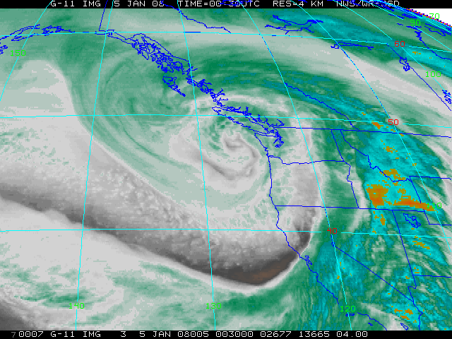 Satellite image of Northwestern U.S. water vapor on 1/4/08, courtesy NOAA/NWS |
 ESRL Polarimetric X-Band Radar, Blue Canyon, CA |
Staff from the Physical Sciences Laboratory at the NOAA Earth System Research Laboratory (ESRL) are set to brave extreme conditions to study a once-in-a-decade storm in California, as a part of the NOAA Hydrometeorological Testbed (HMT) project. The storm, which begins on Thursday, January 3rd and will last for approximately 4 days, is expected to produce a triple punch with heavy rains and flooding at lower elevations, extreme snowfall in the Sierra Mountains and high winds over much of California. The ESRL HYDRO-X radar, located high in the Sierra at Blue Canyon, may see some rain but primarily will face five feet of new snow (or more; on top of the three feet of snow already on the ground from previous storms) and winds in excess of 60 knots whipping up blizzard conditions. This year, Blue Canyon is the focus of ESRL research aimed at improving NOAA's radar-derived quantitative precipitation estimation (QPE) capabilities using high-resolution, gap-filling radars. Blue Canyon is centered amongst dense network of precipitation gages and other instrumentation that can be used to evaluate and verify the radar QPE over the North Fork of the American River. These efforts support hydrologic-model development in the National Weather Service and high-resolution numerical weather prediction research in NOAA's Office of Oceanic and Atmospheric Research (OAR).
The NOAA Hydrometeorological Testbed is a regionally implemented national strategy with the objective of enhancing and accelerating weather research into operations. The first testbed, centered on the American River Basin above Sacramento, CA, is in it's third full year. HMT combines state-of-the-art observing systems and numerical modeling to develop decision support tools for extreme precipitation that can be transitioned into forecast operations in the NWS. HMT-East will begin in FY09-FY10.
The HMT provides a laboratory for NWS hydrologists and meteorologists to work closely with researchers from OAR to develop and evaluate new methods of monitoring and predicting extreme precipitation. While Sacramento sits at the confluence of the Sacramento and American Rivers and represents a flood-risk that is comparable to New Orleans and Hurricane Katrina. Lessons learned in the HMT in this region can be applied elsewhere, particularly to the entire West Coast. This research supports NOAA's mission goal of serving society's needs for weather and water information.
| Contact: Tim Schneider | More Information: |