Weather Forecasts
Daily Weather Summary
July 14, 1999:
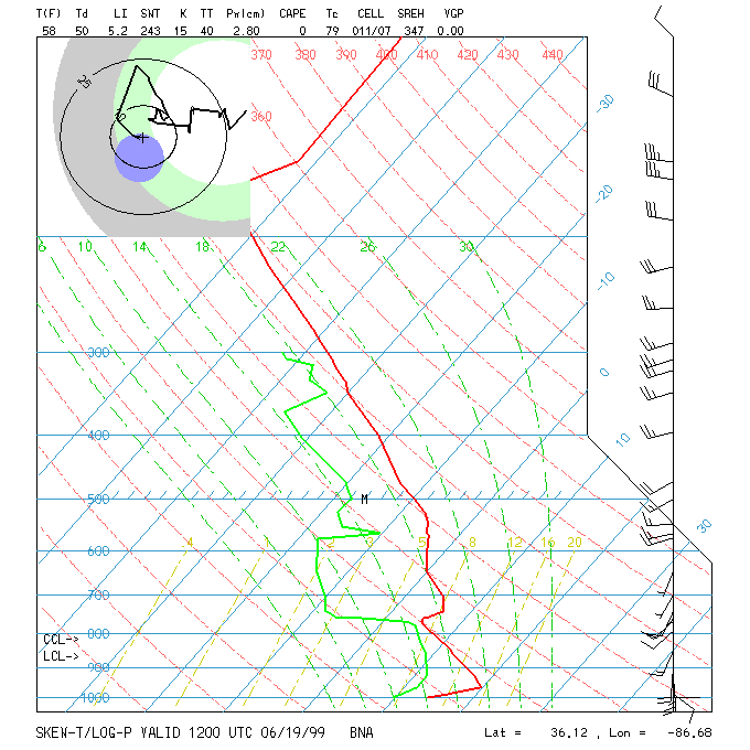
12Z BNA Sounding shows a VERY moist layer basically from the surface up to 650 mb, then above that a sharp subsidence inversion. With all this low-level moisture, there will be quite a few clouds, mainly from BNA on east, for the rest of the day, with Cu clouds forming from BNA westward. Also, as upper trough swings by, a few thunderstorms may pop again this afternoon, like yesterday. These will be most likely in the area recieving the most sun this morning, from BNA southwestward into SW Tennessee. High: 86 Low: 69 Mixing Hgt.: 2000 m MSL. 850 mb winds should be out of the SW and light, < 8 knots.
Tomorrow's Forecast
July 15, 1999:
On Thursday, surface ridge starts to build in, so expect partly cloudy skies and isolated afternoon thunderstorms. High: 89 Low: 70. 850 mb winds tomorrow will be light out of the SW.
Day after Tomorrow Forecast
July 16, 1999:
Surface and 500 mb high pressure building in, so expect typical summertime weather -- partly cloudy skies with scattered afternoon and evening thunderstorms. High: 90 Low: 71
Outlook
Friday's pattern continues. Highs: 89-93 Lows: 70-74.
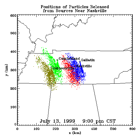
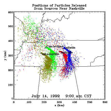
Profiler Plume Depiction
The following shows a depiction of plume locations as predicted by the profiler winds assimilated into a one-dimensional boundary layer model. The top image shows particle positions as of the previous evening. The lower image shows particle positions as of the following morning for particles released beginning the previous noon.
Forecast Plumes
The following gives a depiction of plume locations using a Lagranagian Particle Model coupled to the Regional Spectral Model. The RSM is run daily in a forecast mode at TVA Muscle Shoals, Alabama.
Plume based on 00z initial fields (mpg file optimized for QuickTime)
Plume based on 12z initial fields (mpg file optimized for QuickTime)
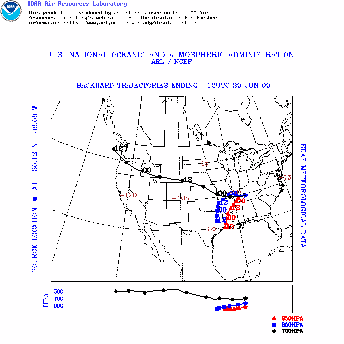
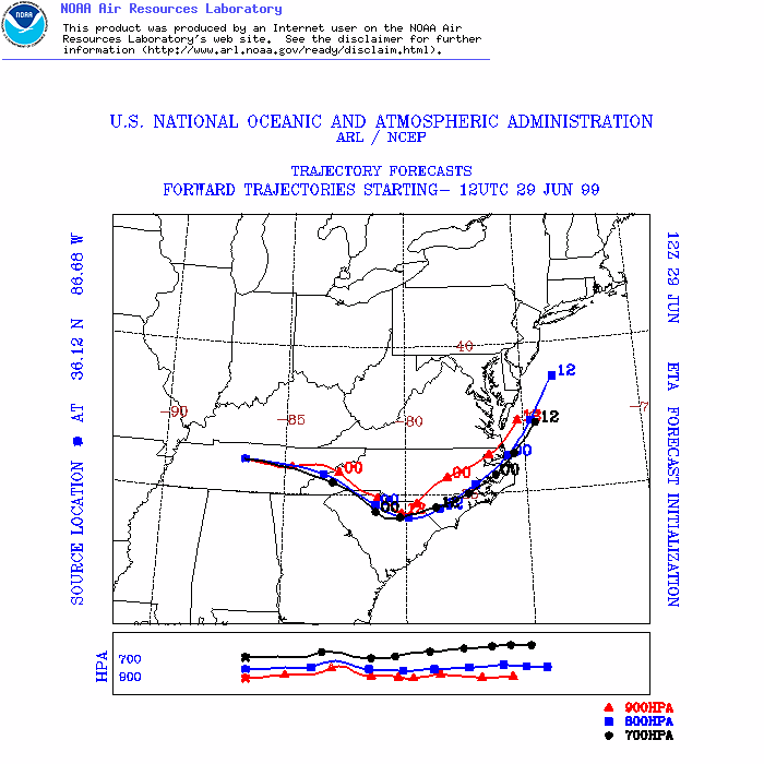
ARL Hysplit Trajectories
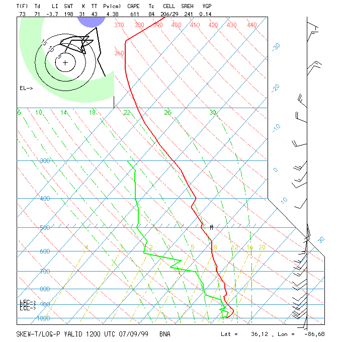
Nashville Soundings