LLLJP Measurements: Conical, Vertical-slice, Staring
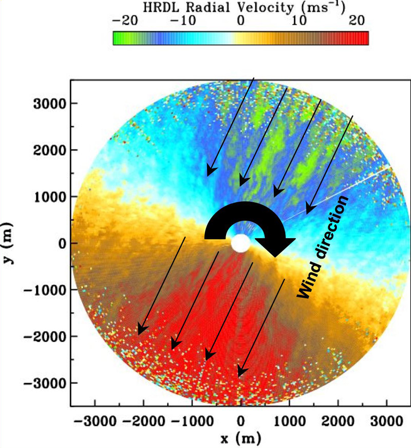
Conical scans
were performed in full 360° and at low elevations to estimate the horizontal structure of the wind flow near the surface and display the main direction of wind vector. Available products computed from these scans are profiles of mean wind speed and wind direction.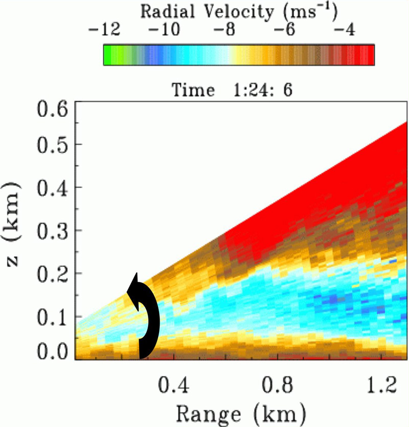
Vertical-slice scans
were performed by sweeping the atmosphere up to 20° an elevation angles and by pointing lidar beam parallel to the main wind direction, that was determined from conical scans. Available products computed from these scans are profiles of mean horizontal wind and turbulence.HRDL data were collected during the nighttime, from local sunset until sunrise from 1 to 16 September 2003. Measurements were performed in a conical and vertical-slice scanning modes to meet a different objectives of the project. Occasionally, measurements were performed by pointing lidar beam at fixed azimuth and elevation angles (fixed beam mode).
Most of the time the HRDL was scanned in the vertical-slice mode because these scans have shown to be very effective in the analysis of the velocity and atmospheric turbulence, and in the study of low-level jets, which are also very important for a wind-turbine operations. Low-level jet (LLJ) can increase wind resource, but the turbulence generated in the shear zone can damage turbines. Along with analyses of the LLJ evolution such scans were used for the study of gravity waves, evening and morning transition and another atmospheric events.
Fixed-beam measurements were performed by pointing the lidar beam in one direction, referred to as staring or fixed-beam mode.