R/V Ronald H. Brown Daily Summaries
Daily Summary August 4, 2002, DOY = 216
The ship ran east 43 nm overnight in search of the edge of the pollution plume. Aerosol light scattering (70-80 mM-1), ozone (80ppb), and NMHC remained high. N2O5 concentrations were high early in the night. The N2O5 to NO3 ratio decreased during the night as predicted in an aging pollution plume. The ship returned to shore to begin the along-shore sea-breeze track at 1000 UTC. Winds were light (less than 3 m/s) from the NW to NE from 1000 to 1700. The wind shifted to SE at 1700 and increased to 9 m/s by 2100. Ozone concentrations rose all day reaching 110 ppb by 2230. Aerosol light scattering (green) peaked at 140 mM-1 at 2100. Ethylene and propylene concentrations were similar today to that measured in Boston and New York harbors. These short lived species must have a local source. The lack of biogenic hydrocarbons in the air mass suggests a none continental source. Could these species be from the many small boats in the area? At 2200 the ship terminated the alongshore transect and began a course perpendicular to the SE winds from the Merrimack River out past the IOS.
For all plots, time is indicated in GMT. Eastern time is -5 hours.
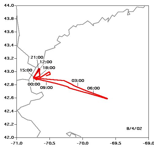 Location |
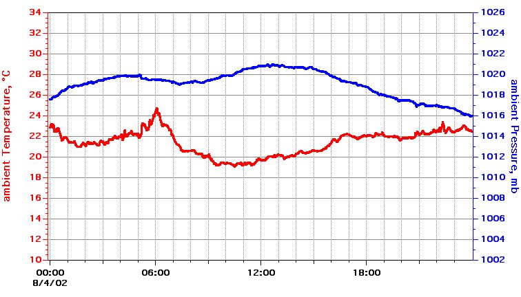 Temperature, Pressure |
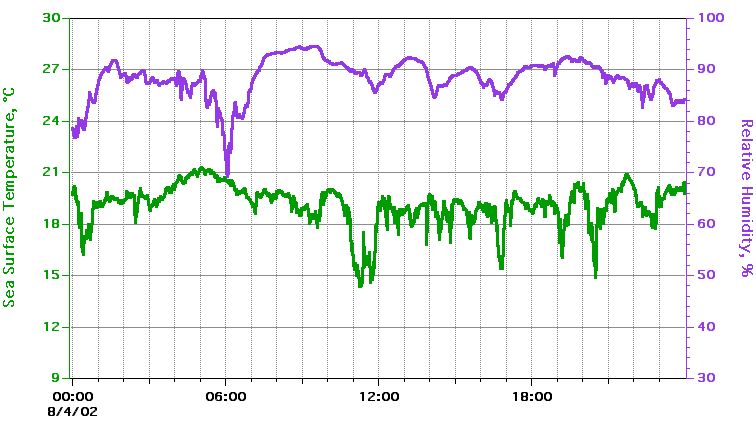 Sea Surface Temperature, Relative Humidity |
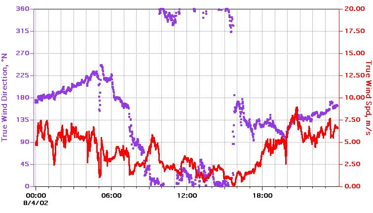 True Wind Speed, Direction |
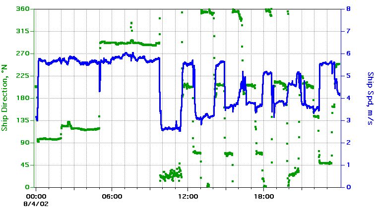 Ship Speed, Direction |
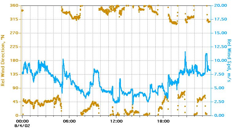 Relative Wind Speed, Direction |
Textual information and data plots are for quicklook and overview purposes only.