
LaPorte Site Map
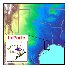
The map shows the general location of the LaPorte ground sampling site during the 2000 TexAQS project. The small inset shows the Houston, Texas metropolitan area outlined in brown.
Portable trailers which housed the instruments and sampling towers were set up at the LaPorte Airport. Measurements were made from August 14 to September 16, 2000.