TexAQS 2006 TOPAZ Lidar data
August 4 - Final Data
| Previous Flight | Archive Calendar | Next Flight |
|---|
Flight #3
Takeoff: 12:10 CDT
Total flight time: 4.9 hours
Winds turned from southerly to easterly and transported emissions from the Ship Channel area to the west over downtown Houston. The Twin Otter flew a raster pattern from east to west over the Houston metro area starting northeast of Galveston Bay. On the first N S transect the Twin Otter flew over the Ron Brown, which was sitting in Barbours Cut. The Twin Otter observed high levels of ozone over and west of downtown Houston with peak ozone concentrations exceeding 120 ppb. Several CAMS surface monitoring stations in the Houston metro area registered 1 hour average ozone values of 120 ppb or more. The location of the high-ozone plume was well predicted by the UH model, but observed levels were higher than predicted by the model, and occurred later in the day.
Select an image to view full resolution
Ozone Cross-section download ICARTT format data (ict file) download simple ASCII data (txt file) |
Aerosol Cross-section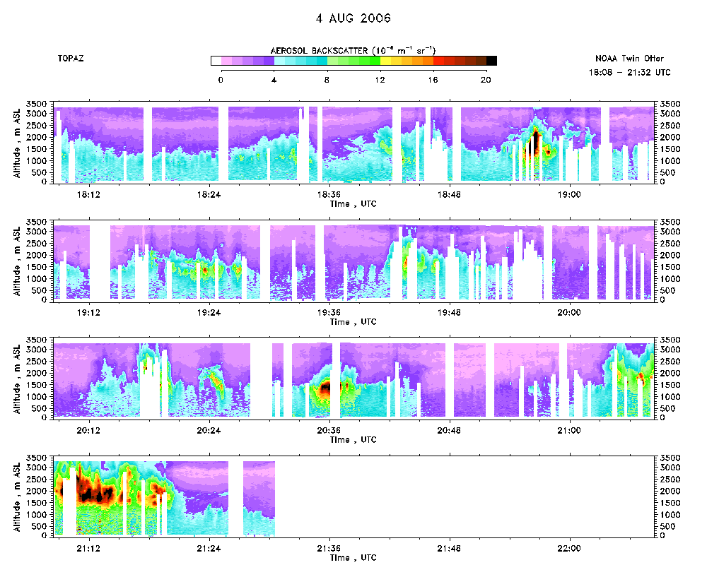 download ICARTT format data (ict file) download simple ASCII data (txt file) |
Ozone Map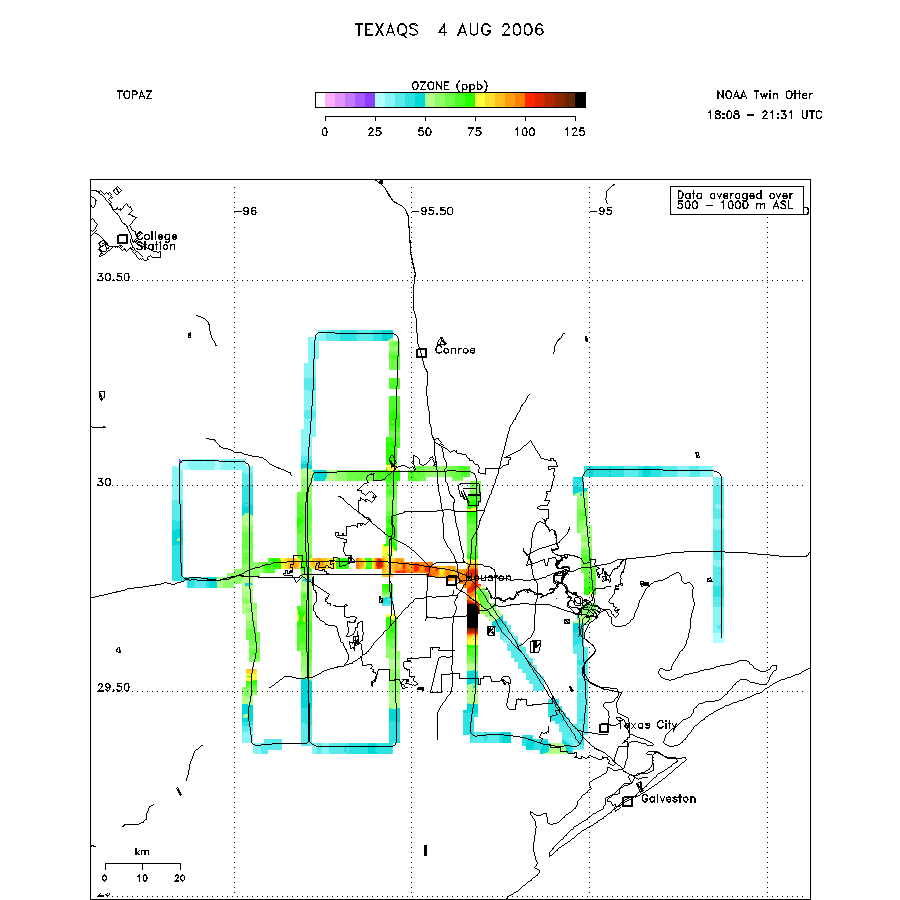 |
Mixed Layer Height Map download ICARTT format data (ict file) download simple ASCII data (txt file) |