TexAQS 2006 TOPAZ Lidar data
August 30 - Final Data
| Previous Flight | Archive Calendar | Next Flight |
|---|
Flight #16
Takeoff: 13:17 CDT
Total flight time: 6.4 hours
Flight sampled the ozone plume to the south of the urban area, emitted into clean, northerly post-cold-frontal winds of about 5 m/s. Five east-west legs and a final southwest-northeast leg found a plume that reached an estimated 130-140 ppb reaching only about 1.2-1.3 km height. Earlier cross sections closer to the sources indicated lower ozone concentration of approx. 110 ppb, but later cross sections farther from the urban/ship channel had the higher concentrations.
Select an image to view full resolution
Ozone Cross-section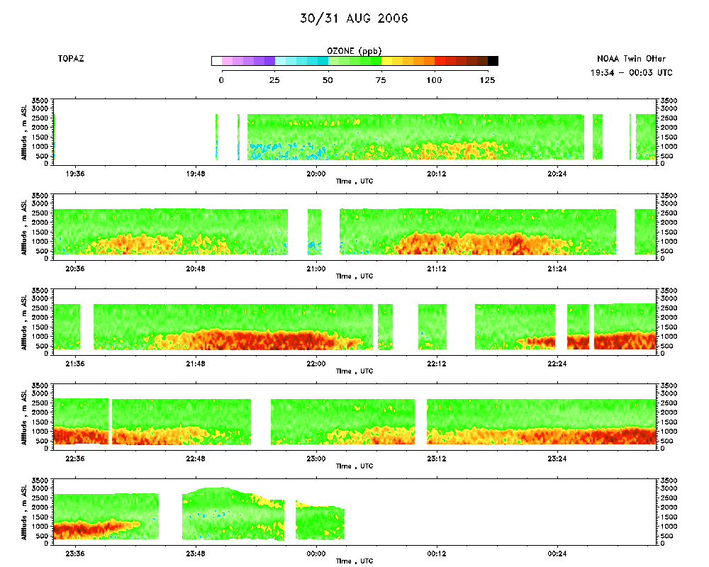 download ICARTT format data (ict file) download simple ASCII data (txt file) |
Aerosol Cross-section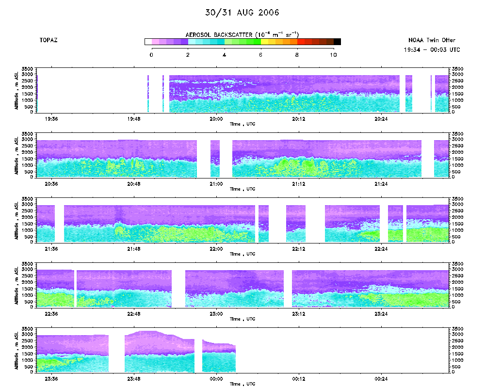 download ICARTT format data (ict file) download simple ASCII data (txt file) |
Ozone Map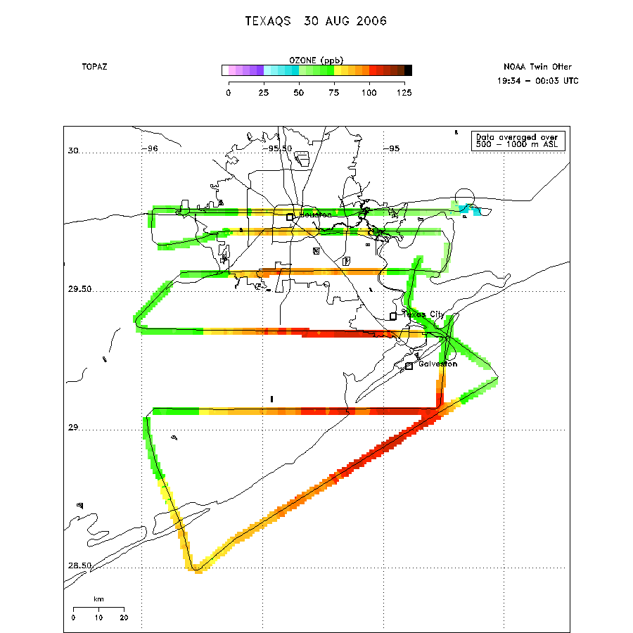 |
Mixed Layer Height Map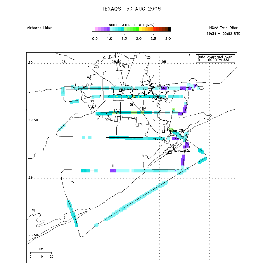 download ICARTT format data (ict file) download simple ASCII data (txt file) |