TexAQS 2006 TOPAZ Lidar data
August 24 - Final Data
| Previous Flight | Archive Calendar | Next Flight |
|---|
Flight #14
Takeoff: 15:36 CDT
Total flight time: 3.7 hours
A short flight was intended to test laser/lidar adjustments made the previous day and fly over the Ronald H. Brown. Flow was light (3-4 m/s) and southwesterly, becoming even lighter and westerly for about 1 h starting at 1200 CDT. A thundershower passing to the south of Ellington delayed takeoff, and clouds inland were a problem for airborne lidar sampling. The flight started out in the clear over the Gulf, and the lidar performed well. Very low ozone concentrations of approx. 20 ppb or less were noted over Galveston Bay, but higher concentrations appeared aloft with 60 ppb or more above 1800 m MSL. Aerosol concentrations were opposite, with high concentrations below 1 km and low concentrations above ~2 km. Passing northward along the western shore of Galveston Bay, ozone concentrations increased and the aerosol seemed to become more vertically mixed. An E-W leg north of the city showed two ozone maxima of >120 ppb, one representing the ship channel and one the urban center. The ozone and high aerosol concentrations jumped vertically to ~2400 m downwind of the urban center, whereas the mixed layer height farther east was more like 1400 m, a probable urban heat island effect. Ron Brown overpasses occurred at 17:17 and 17:23 CDT.
Select an image to view full resolution
Ozone Cross-section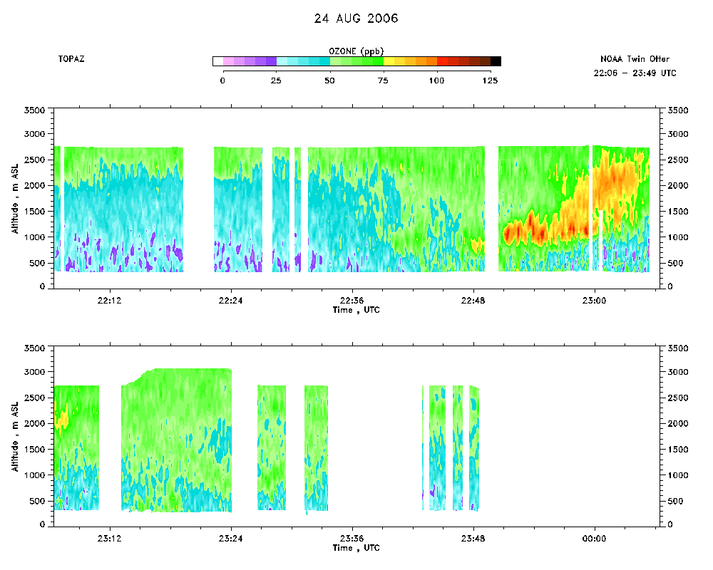 download ICARTT format data (ict file) download simple ASCII data (txt file) |
Aerosol Cross-section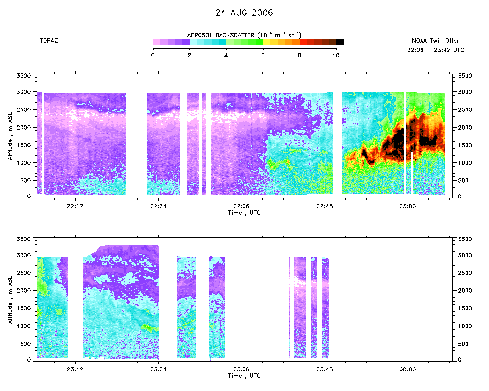 download ICARTT format data (ict file) download simple ASCII data (txt file) |
Ozone Map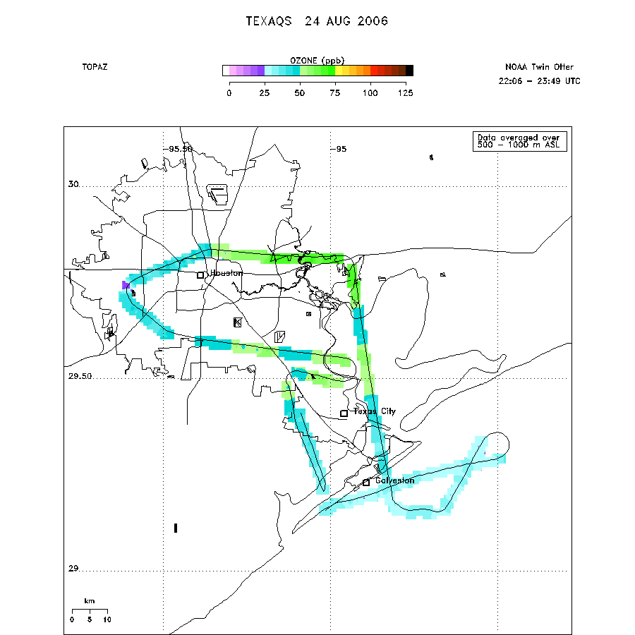 |
Mixed Layer Height Map download ICARTT format data (ict file) download simple ASCII data (txt file) |