TexAQS 2006 TOPAZ Lidar data
August 17 - Final Data
| Previous Flight | Archive Calendar | Next Flight |
|---|
Flight #11
Takeoff: 12:51 CDT
Total flight time: 6.0 hours
Winds were northerly through northeasterly before noon, (driving pollution to south/southwest of source region), becoming light and variable during the midday hours until a southeasterly sea-breeze flow formed after 15:00 CDT. Higher moisture than on previous days produced late-day cumulus convection, which affected afternoon flight tracks over the city and to the southwest. Very high ozone concentrations similar to previous day were seen on this day, but this time south and southwest of the urban area. BL heights were mostly ~1.5 km, humping up to 2 km over the urban area. Impressive, multilayered aerosol structure was evident up to at least 2 km.
Select an image to view full resolution
Ozone Cross-section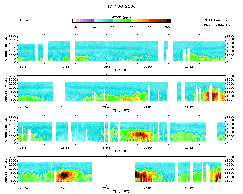 download ICARTT format data (ict file) download simple ASCII data (txt file) |
Aerosol Cross-section download ICARTT format data (ict file) download simple ASCII data (txt file) |
Ozone Map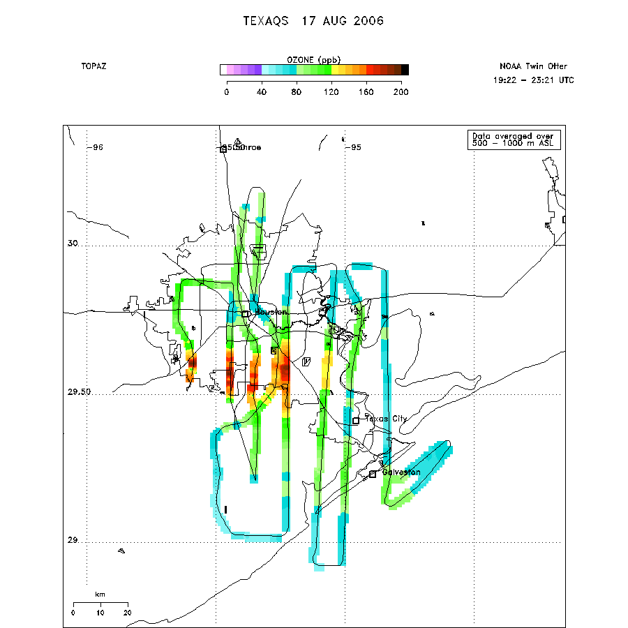 |
Mixed Layer Height Map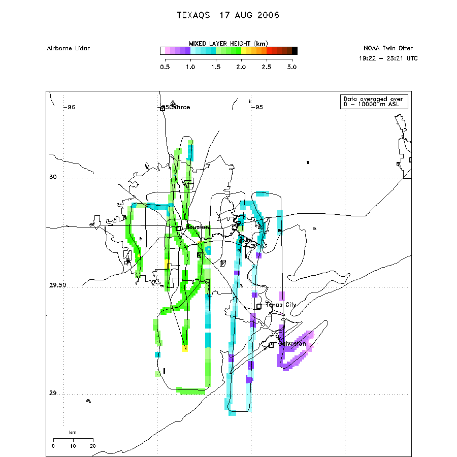 download ICARTT format data (ict file) download simple ASCII data (txt file) |