CalNex TOPAZ Lidar data
June 7 - Flight A - Preliminary Data
| Previous Flight | Archive Calendar | Next Flight |
|---|
Flight #13: Los Angeles Basin
Flight level: 5500 MSL
Takeoff : 09:30 PST
Duration : 3:30 h
Objective : Survey pollution in LA Basin.
Select an image to view full resolution
Ozone in Google Earth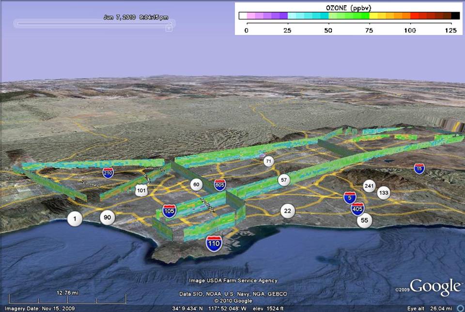 Get the Google Earth kml file |
Ozone Cross-section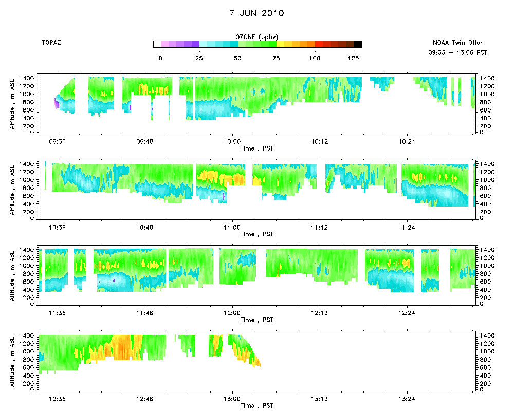 Download the ASCII file |
|---|