CalNex TOPAZ Lidar data
June 26 - Preliminary Data
| Previous Flight | Archive Calendar | Next Flight |
|---|
Flight #26: Sacramento, east and south of Bay Area, coastal foothills and northern SJV
Flight level: 11500 - 16500 MSL
Takeoff : 16:15 PST
Duration : 3:48 h
Objective : Survey pollution near Sacramento, east and south of Bay Area, measure outflow from Bay Area to SJV over Altamont and Pacheco passes. High ozone layer of suspected Asian origin above 4 km.
Select an image to view full resolution
Ozone in Google Earth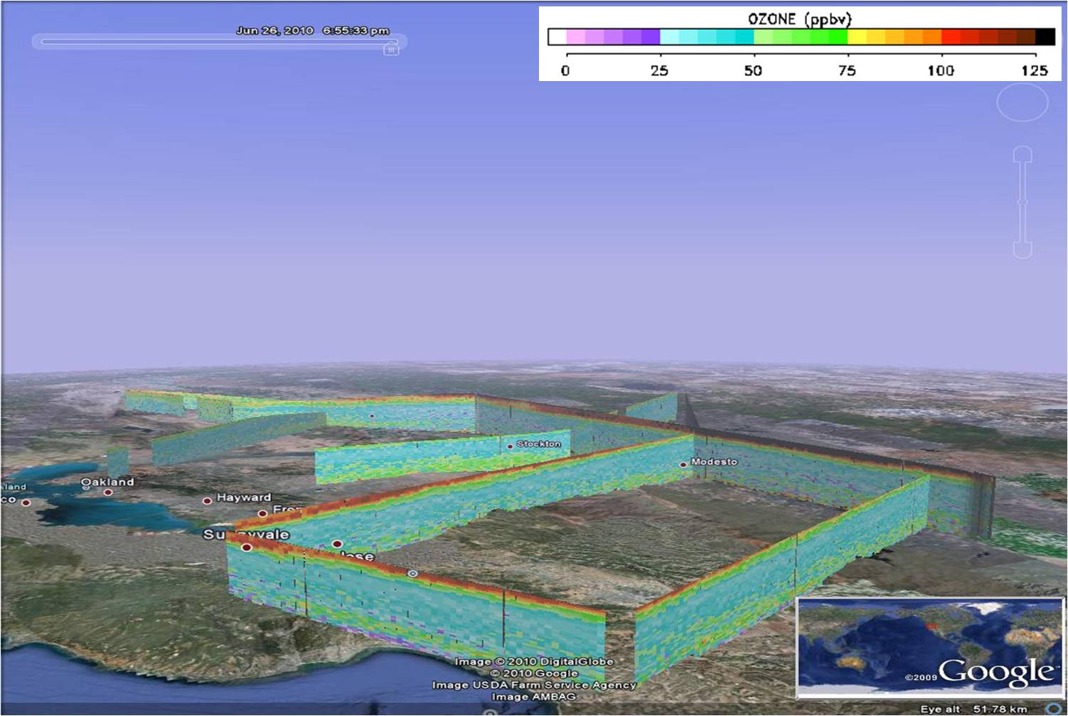 Get the Google Earth kml file |
Ozone Cross-section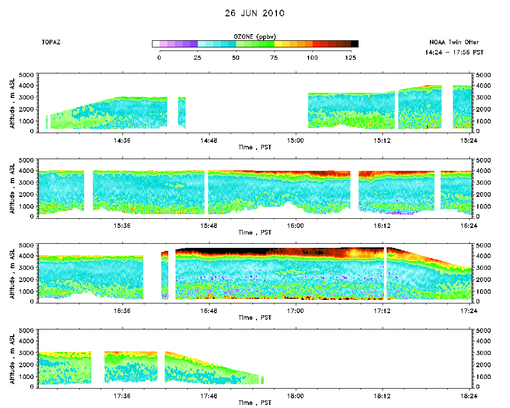 Download the ASCII file |
|---|