CalNex TOPAZ Lidar data
June 22 - Flight B - Preliminary Data
| Previous Flight | Archive Calendar | Next Flight |
|---|
Flight #22: Sacramento Valley and Northern Coast
Flight level: 6500 - 16500 MSL
Takeoff : 13:00 PST
Duration : 3:10 h
Objective : Compare with OMI satellite near Sacramento, sample inflow of Asian pollution over Northern Coast and Sacramento Valley
Select an image to view full resolution
Ozone in Google Earth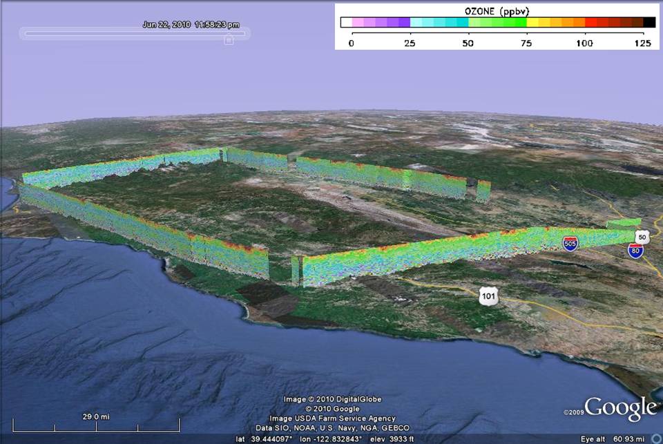 Get the Google Earth kml file |
Ozone Cross-section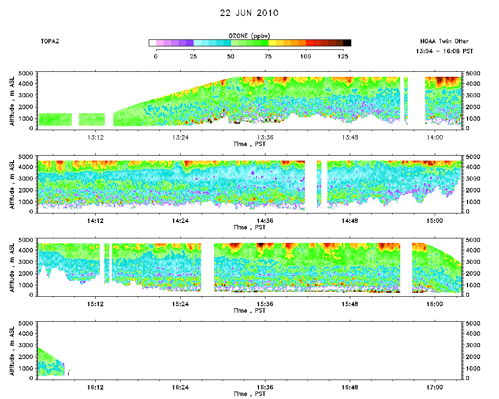 Download the ASCII file |
|---|