CalNex TOPAZ Lidar data
July 14 - Flight B - Preliminary Data
| Previous Flight | Archive Calendar | Next Flight |
|---|
Flight #41: Survey pollution in the San Joaquin Valley
Flight level: 12500-14500 MSL
Takeoff : 19:00 PST
Duration : 4:00 h
Objective : Survey O3 and other pollutants in the San Joaquin Valley. Study the role of mountain slope flows and the low level jet in redistributing pollutants.
Select an image to view full resolution
Ozone in Google Earth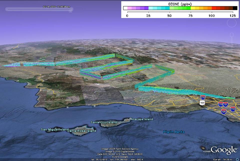 Get the Google Earth kml file |
Ozone Cross-section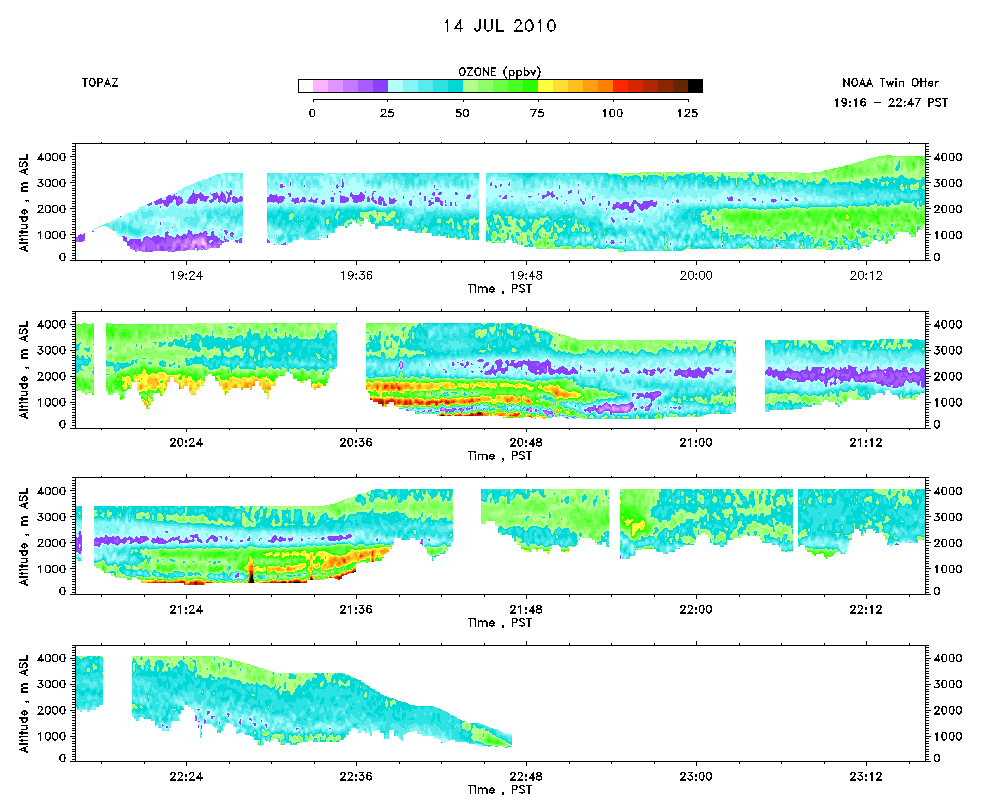 Download the ASCII file |
|---|